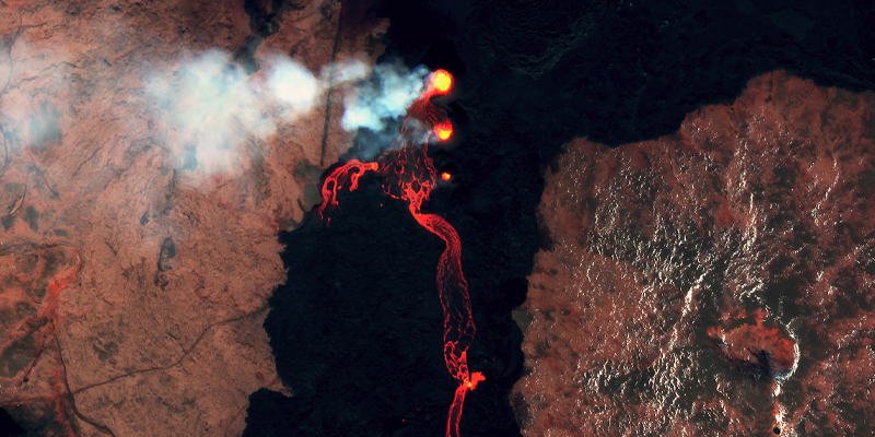
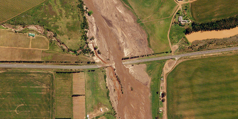
Climate Change, Global Events, Social Impact, Technology April 16, 2024 Space Data for Disaster Risk Monitoring and Mitigation Volcanic Eruptions in Iceland
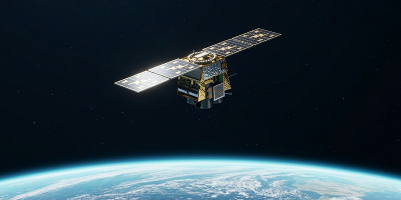
Earth Observation, Technology March 20, 2024 NewSat Mark-V: Satellite Enhancements Overview Increased capacity, new swath sizes, and 70cm native resolution
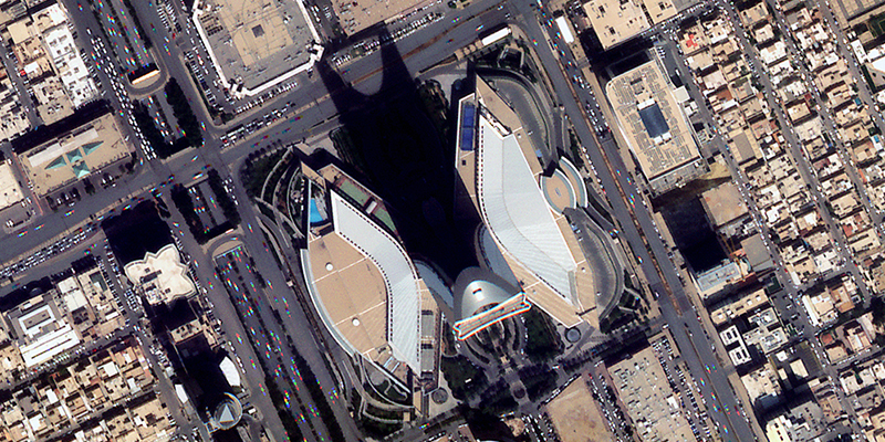
Climate Change, Company, Earth Observation, Global Events, Space, Technology February 22, 2024 Harnessing Satellite Imagery Archives for Strategic Decision Making Explore an Extensive Archive of Data from Satellogic
Climate Change, Company, Earth Observation, Global Events, Space December 13, 2023 Low-Latency Satellite Imagery for Rapid Response Task and access satellite imagery in under 6 hours
Community, Company, Space November 8, 2023 Quant Data & Analytics Leverages Satellogic’s 70cm Imagery: A New Era in Geospatial Precision Achieving Cost-Effective Building Detection with High-Accuracy 70cm Data
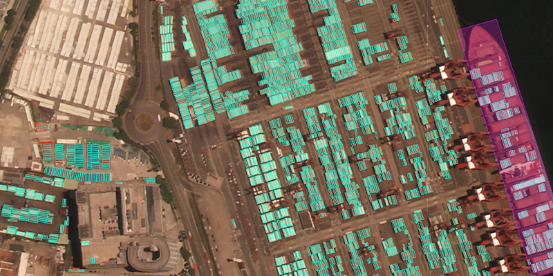
Earth Observation, Technology October 5, 2023 Port Monitoring with AI applied to Satellite images Using satellite imagery by Satellogic, HappyRobot trained an AI model able to identify individual shipping containers and different types of vessels, at any port.
Community, Company, Space September 5, 2023 Satellogic NewSat Satellite Re-Entry Strategy Spacecraft End-of-Life Protocol and Anticipated Deorbits
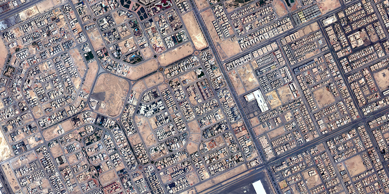
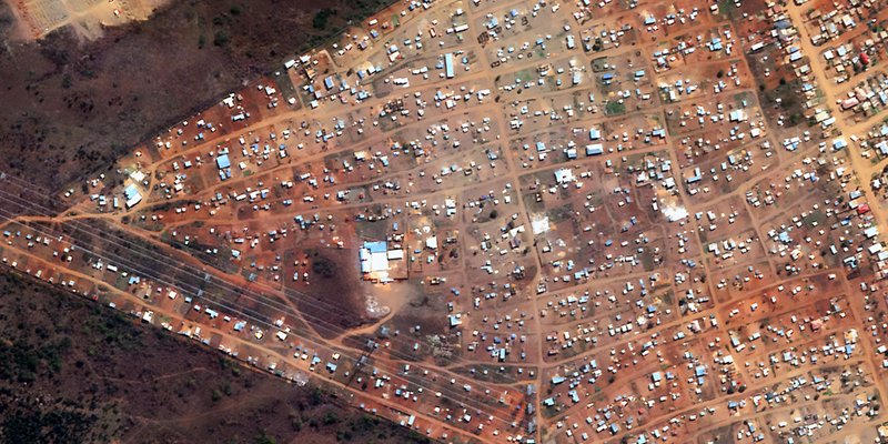
Climate Change, Community, Company, Earth Observation, Global Events, Space August 22, 2023 Advancing Urban Development Management An Automated Building Development Detection and Mapping System from GeoTerraImage
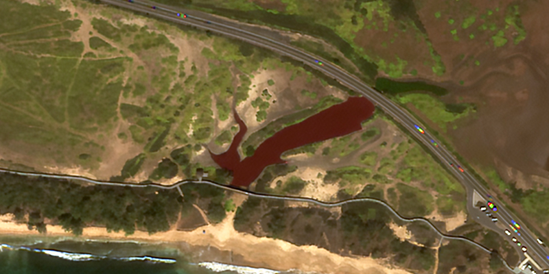
Climate Change, Earth Observation, Global Events July 31, 2023 La Palma Wildfire Assessment: July 2023 False color analysis and applications to mitigate fire risks