Low-Latency Satellite Imagery for Rapid Response
Task and access satellite imagery in under 6 hours
Rapid access to satellite data is crucial for many satellite-based applications such as disaster response, homeland security, and humanitarian crisis, just to name a few.
In order to assess time-sensitive situations, every minute counts. Satellite data can provide critical information for situational awareness and help response teams to make informed decisions. By capturing low-latency data, authorities are able to have the most updated information at their fingertips.
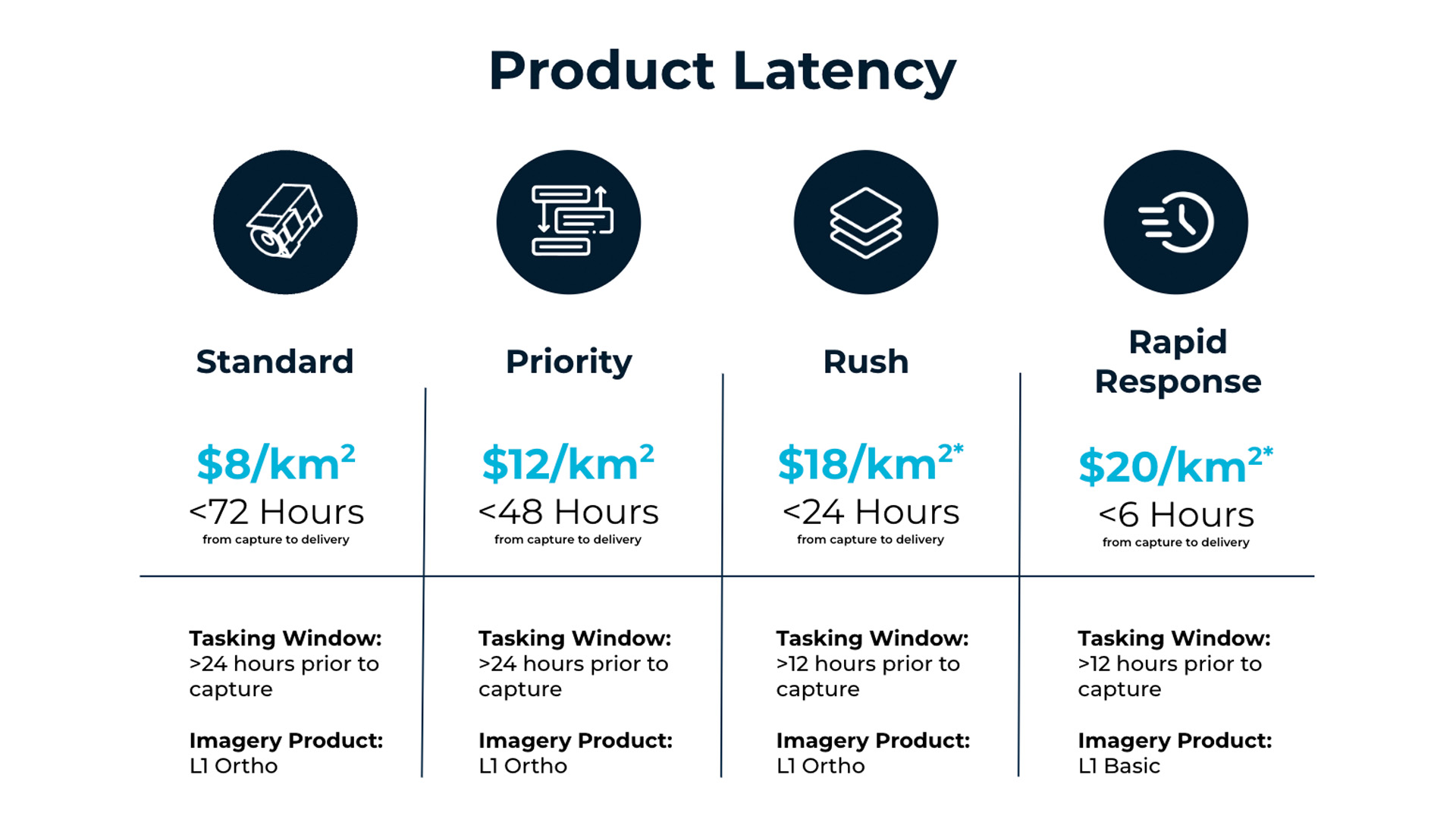
Data Latency describes how quickly the data can be captured and delivered to the end user.
Total latency is the amount of time that passes between tasking the satellite and receiving the imagery. Several factors, like collection planning, up/downlink, and processing can affect the speed at which data is transferred.
We can break up the total latency into two key phases:
- Tasking Window: Amount of time it takes between tasking order acceptance and the next available capture opportunity. This includes collection planning and uplink of the new plan to the satellite constellation,
- Capture-To-Delivery Time: The time it takes between when a capture is taken and delivered to the customer. This includes downlink of the data and time to process the raw data to the desired processing level.
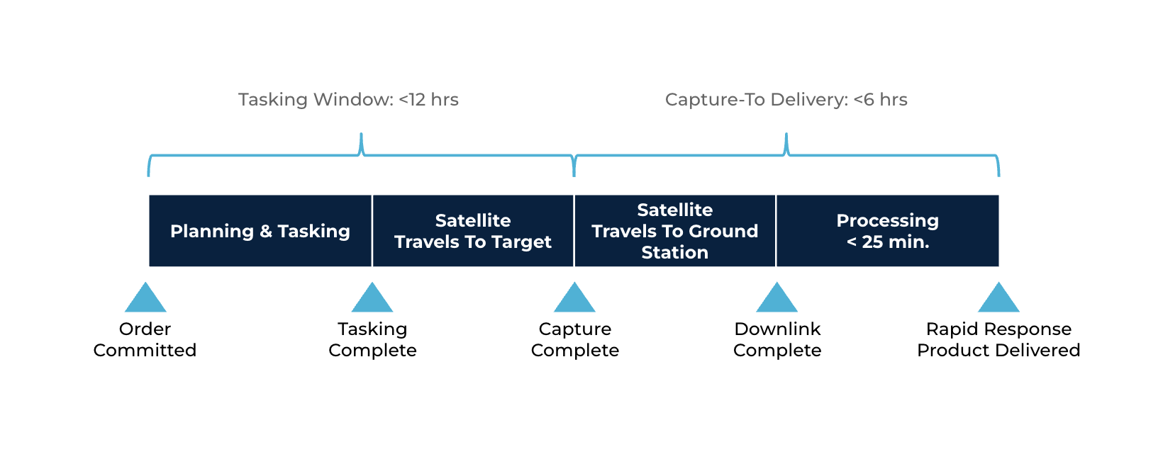
Satellogic’s lowest-latency tasking tier, Rapid Response, delivers our L1 Basic imagery product with a global average Capture-To-Delivery time of less than 6 hours.
The Capture-To-Delivery latency can be further reduced to <3 hours by boosting the amount of downlink passes, which decreases downlink time. This is currently available for high-demand areas and on request for large-volume orders (please contact our sales department for more information).
Rapid Response use cases from customers:
- Dark vessel detection
Unlike legally operated boats, dark vessels don’t broadcast their location using an automated identification system in order to evade monitoring, control, and surveillance. With our industry-leading low latency product, Satellogic customers are able to task and assess imagery over open water more quickly, helping to detect and track moving objects like dark vessels.
- Conflict monitoring
Shifting ground conditions and military movement can increase risk and affect humanitarian operations–including communications and surveillance sources. Satellogic’s low-latency imagery is being used in conflict areas for situational awareness, intelligence, and to aid refugee relief operations. In high-demand areas, the data were available in under two hours.
- Disaster and Emergency management
Satellogic is a member of the International Disaster Charter (IDC). As such, we provide low-latency imagery after a catastrophic event when the IDC is activated. We provide this imagery to the IDC under a Creative Commons license so that the imagery can be shared with the first responders who help plan and carry out rescue and recovery operations.
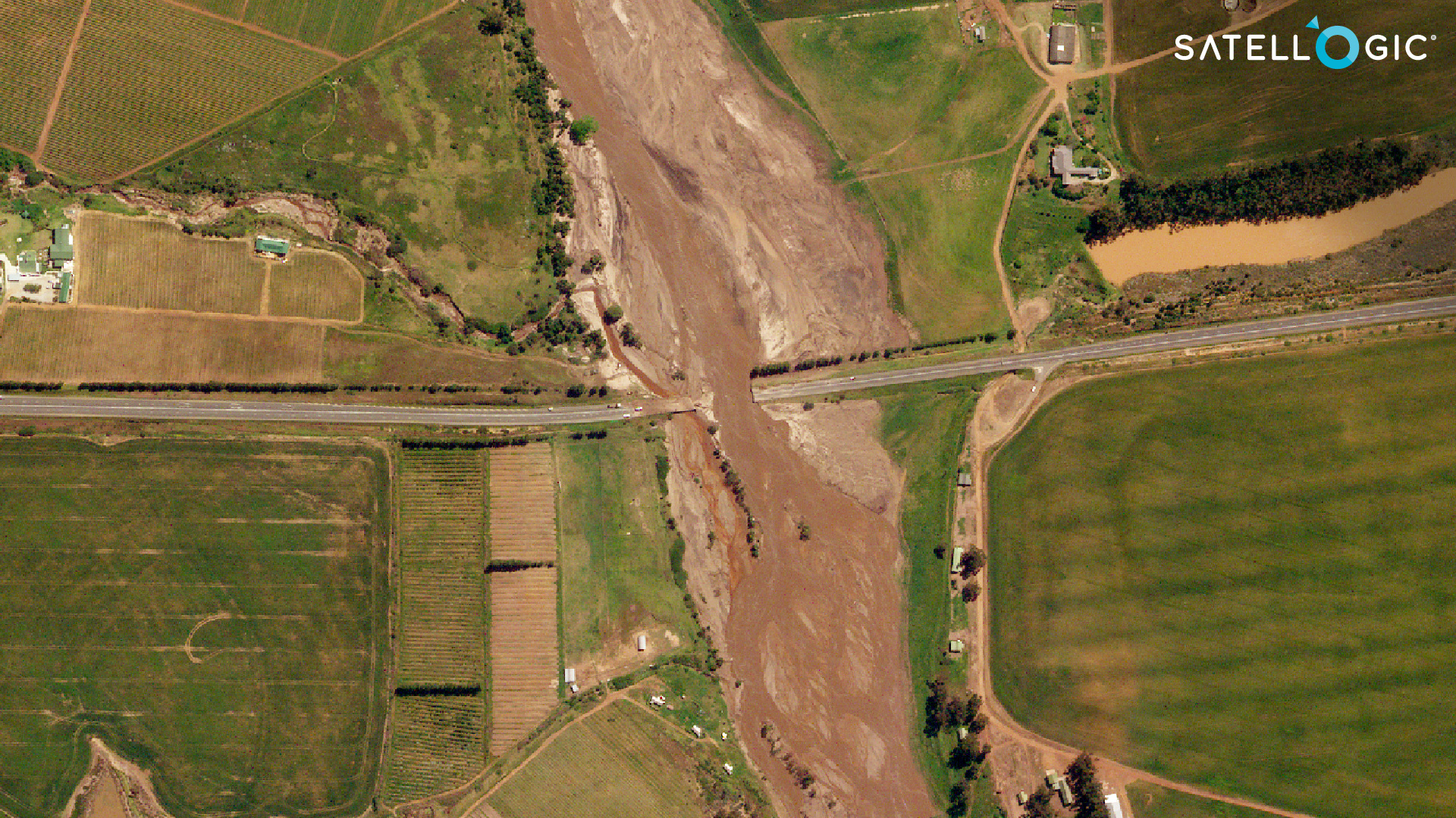
Floods in South Africa’s Western Cape province – This image shows a bridge that has been washed away
on the N2 in the Bot River area. The image was acquired on 1 October 2023
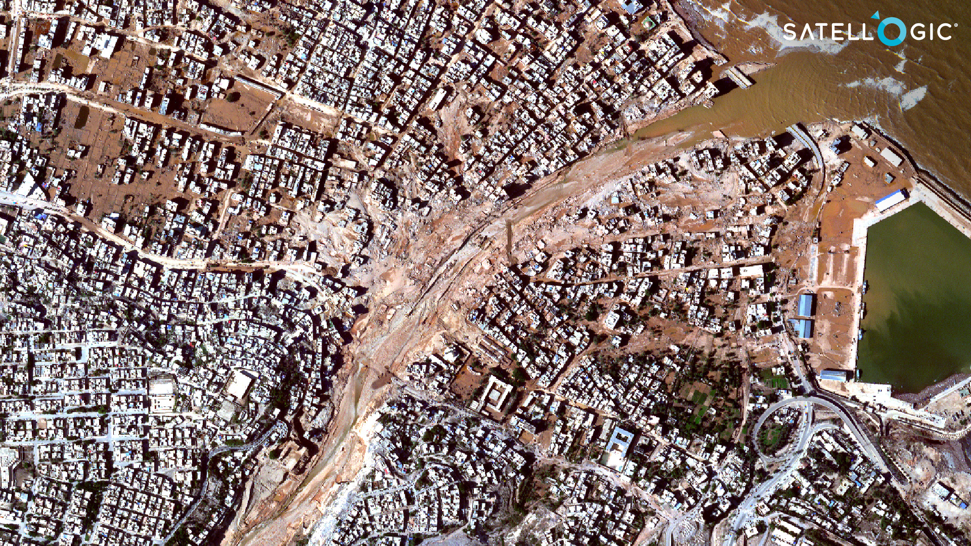
Derna dam collapse, Libya – On September 11, 2023, two dams close to Derna collapsed
in the aftermath of Storm Daniel. The flood partially destroyed the city of Derna.
Rapid Response is currently available for Point Of Interest (POI) tasking and differs from our fully processed imagery products. Customers can task via our imagery platform, our Tasking API, or via email with our Customer Success Team. Low-latency orders are automatically uploaded to a customer-specified S3 bucket or Satellogic-hosted SFTP folder for fast access and bulk downloading.