Space Data for Disaster Risk Monitoring and Mitigation
By Solange Uwera, Senior Presales Engineer
Volcanic Eruptions in Iceland
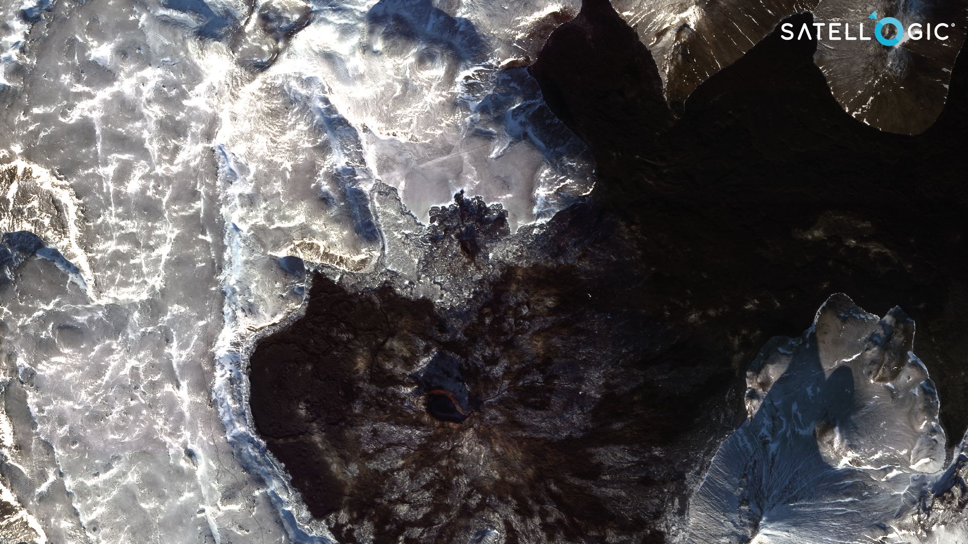
Iceland encountered a surge of volcanic activity on the Reykjanes peninsula, with magma breaking through the surface in December 2023 following about two months of seismic activity, marked by thousands of earthquakes and subterranean magma shifts as observed by Icelandic Met Office. A succession of eruptions occurred near the Sundhnúksgígar crater, situated north of Grindavík town, commencing on December 18, 2023. Satellogic’s satellites captured images of the eruption events, revealing stunning lava flows as the eruptions unfolded.
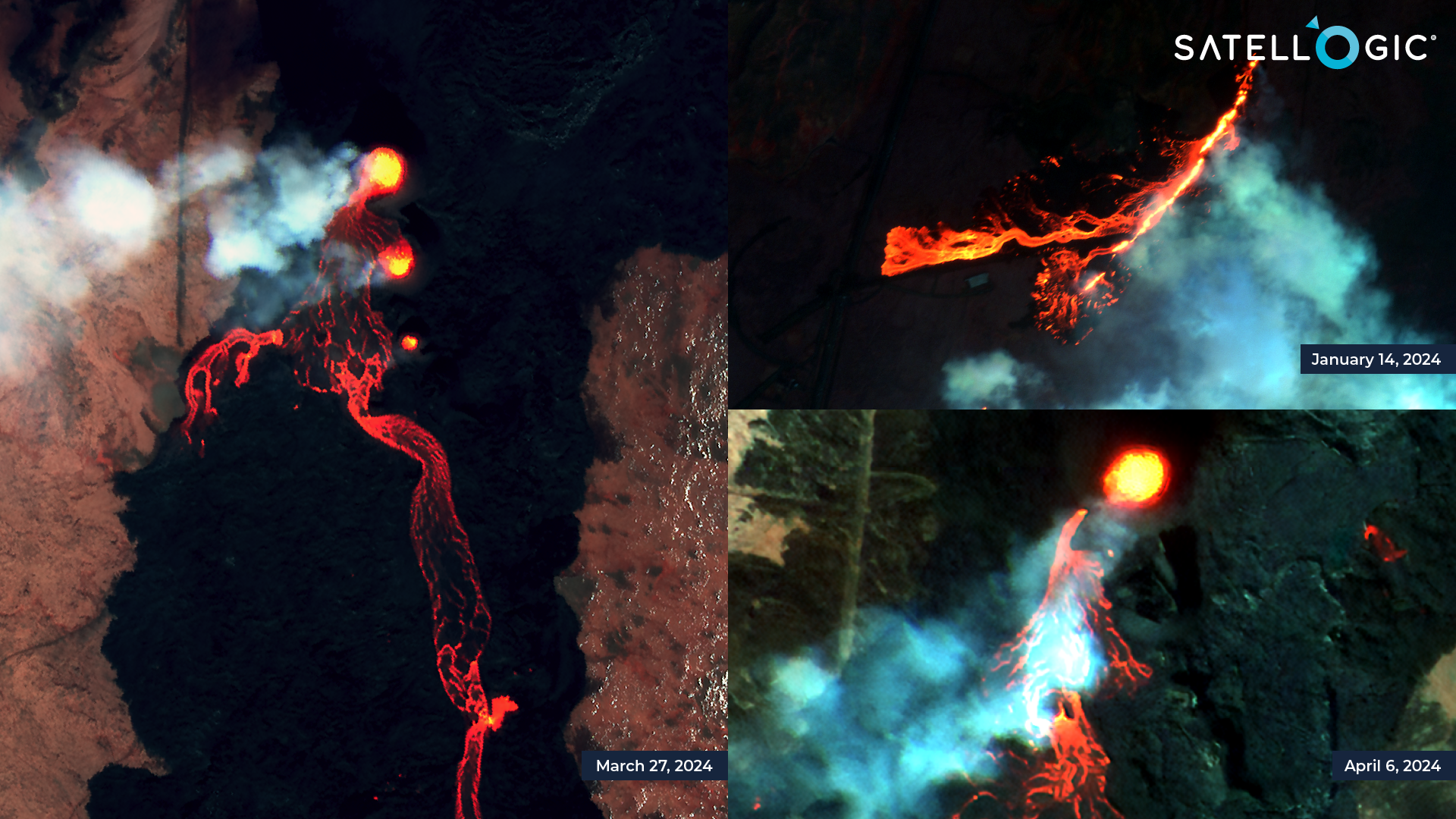
Sundhnúksgígar crater, false colour composites with near infrared, red and green bands.
Volcanic Eruptions Monitoring
Monitoring volcanic eruptions enables emergency services to track changing ground conditions, assess risks, and implement mitigation strategies in remote and hazardous terrain areas. The vantage point of satellites provides an efficient solution to capture volcanic events from a safe distance and, most importantly, in a timely manner – delivering critical information for scientists and civil authorities to make informed decisions more quickly.
Satellogic satellites are equipped to capture images with high temporal, spatial, and spectral resolutions. Our constellation can offer near-real-time insights into the progression of eruptions and the potential hazards they present to nearby communities and infrastructure.
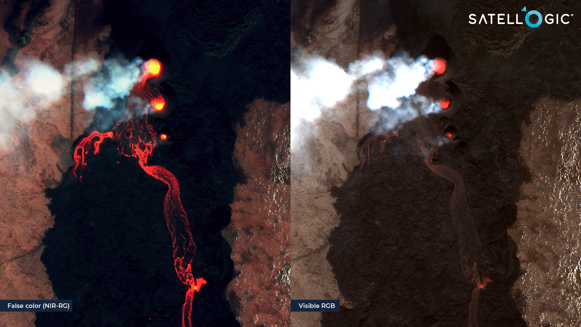
The above images, captured on March 27, 2024 near Sundhnúksgígar crater, visualize an active volcano eruption with near-infrared, red, and green bands, commonly known as a false color composite (left), which differs from the visible or true color composite of red, green, and blue (right), which corresponds to what our eyes naturally perceive. The false color representation shows the real heat reflection from the lava, revealing a more accurateextent of the lava flow and its direction.
High Revisit Frequency
Temporal resolution dictates how often a satellite revisits a location, ranging from hourly to daily, monthly, and beyond. This is crucial during weather conditions like winter, where there is short daylight and low sun elevation, as well as cloud and snow cover hindering clear image acquisition. Therefore, frequent revisits are necessary to capture images as events unfold.
Satellogic satellites captured images of the volcanic area from December to April at a high frequency, often multiple times per day. which increased the chance of capturing clear images even in the most extreme weather conditions.
This timelapse visualization of false color composite of near-infrared, red, and green bands shows the lava extent from December to April around Sundhnúksgígar crater. Notice how near the lava (black), the vegetation (bright red) gets exposed as the lava temperature melts down the snow, which may indicate where lava is still actively flowing.
Damage Assessment and Risk Mitigation
High-frequency monitoring of disaster events enables emergency services to closely monitor their progression, identifying at-risk areas and expediting mitigation measures to minimize damage and loss of life.
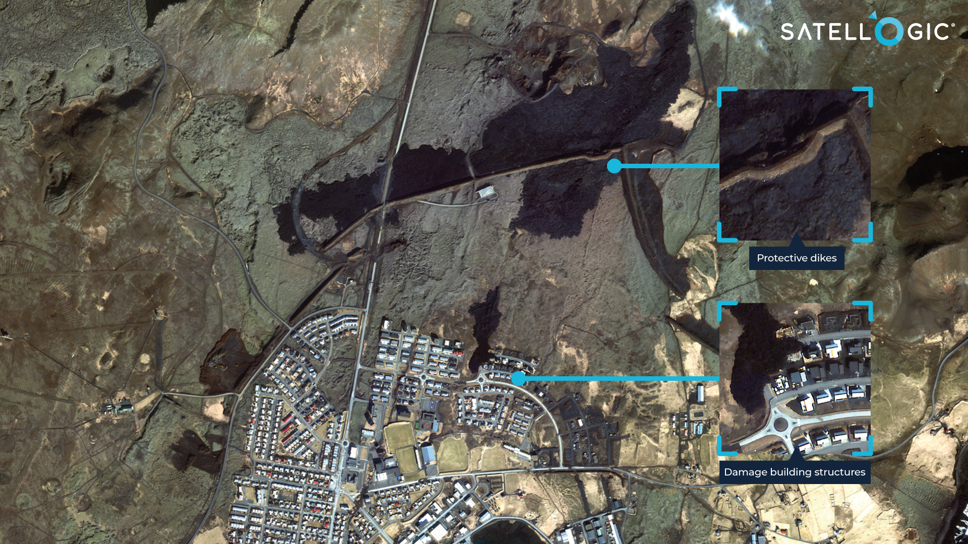
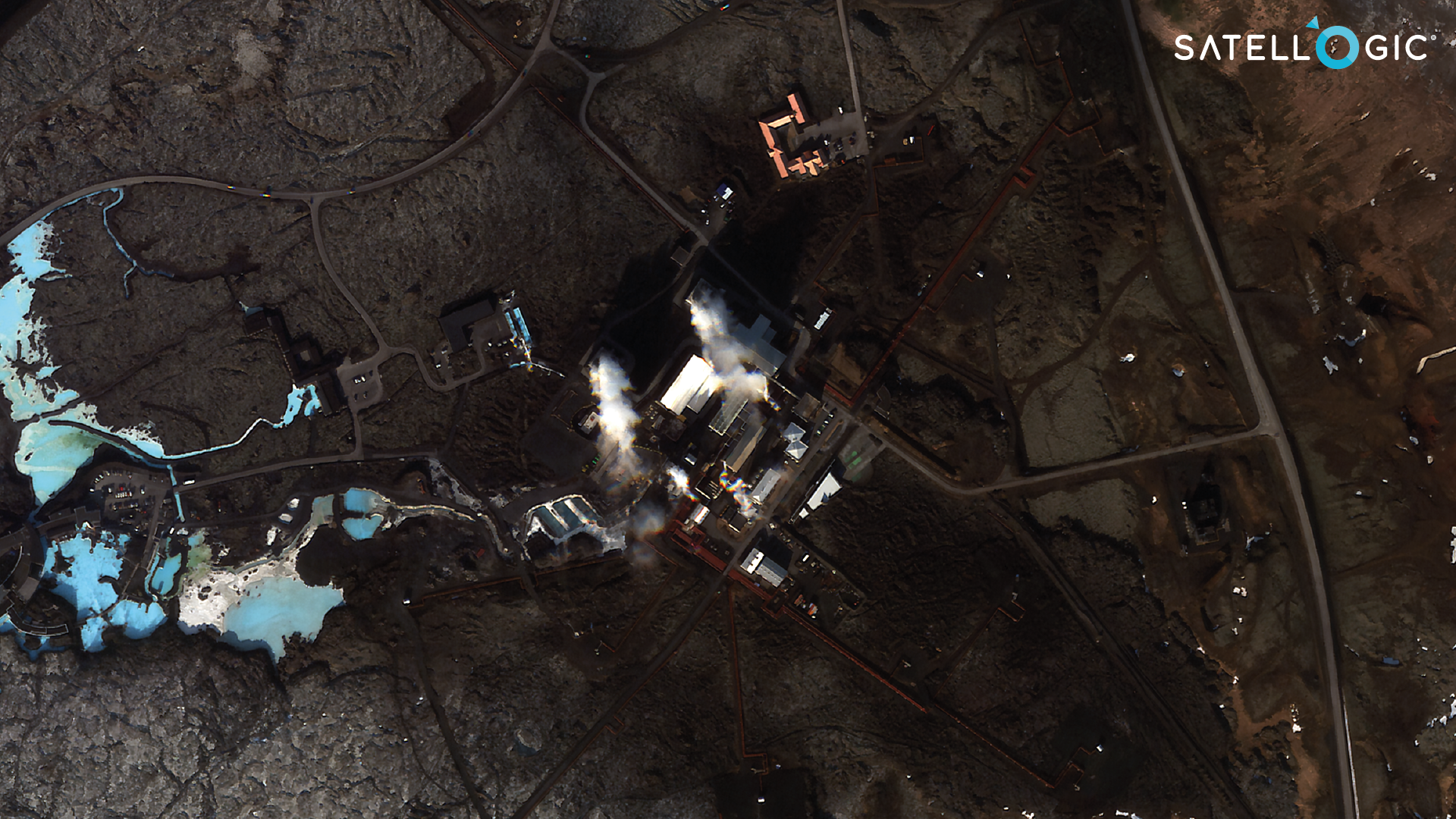
As depicted in the image above from March 11, 2024, emergency services were able to monitor the lava flow, leading to the implementation of protective measures such as the construction of a dike north of Grindavik town, effectively shielding the town from the lava.
In addition to serving as a vital monitoring tool, satellite images are used to conduct a rapid assessment of damages for various purposes, such as evacuation, provision of social assistance, and post-disaster recovery planning. Furthermore, insurance providers can obtain timely information about affected areas and identify impacted properties by comparing images taken before and after the event.
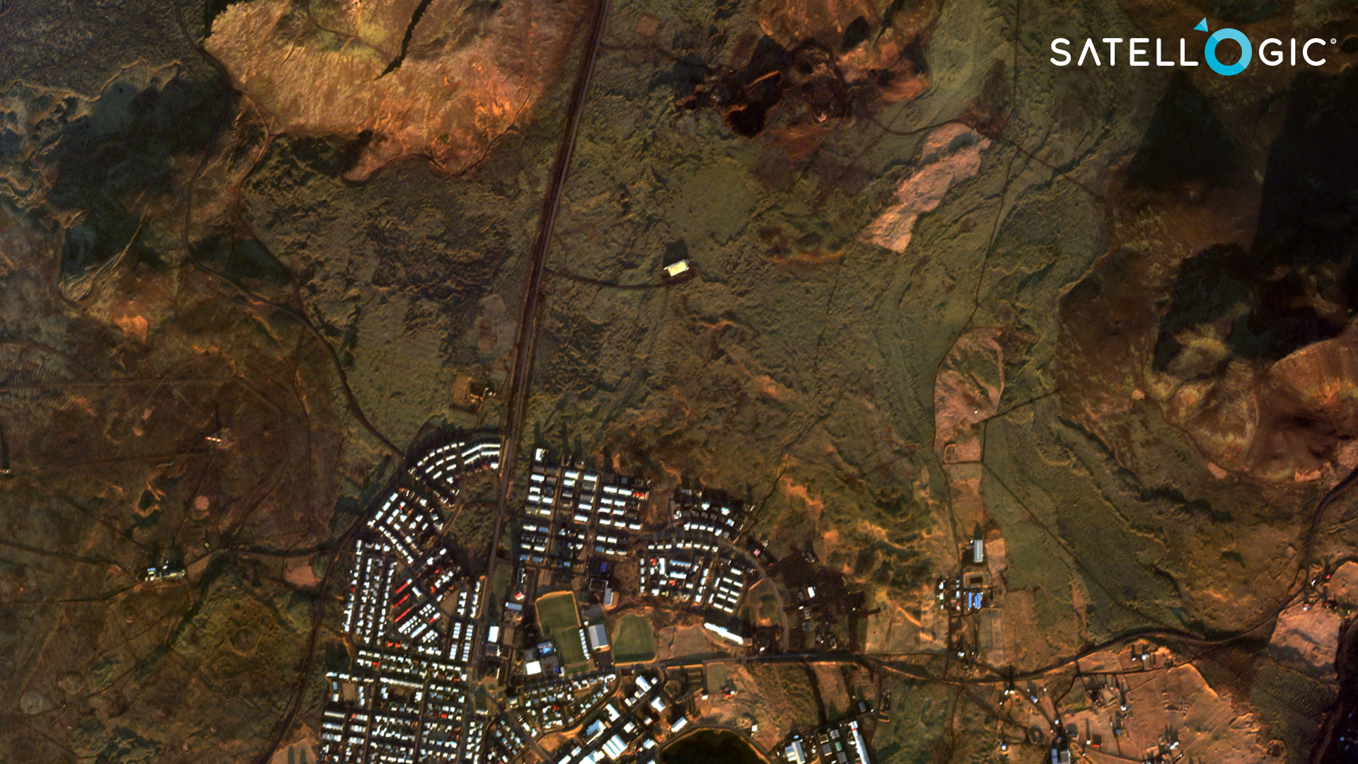
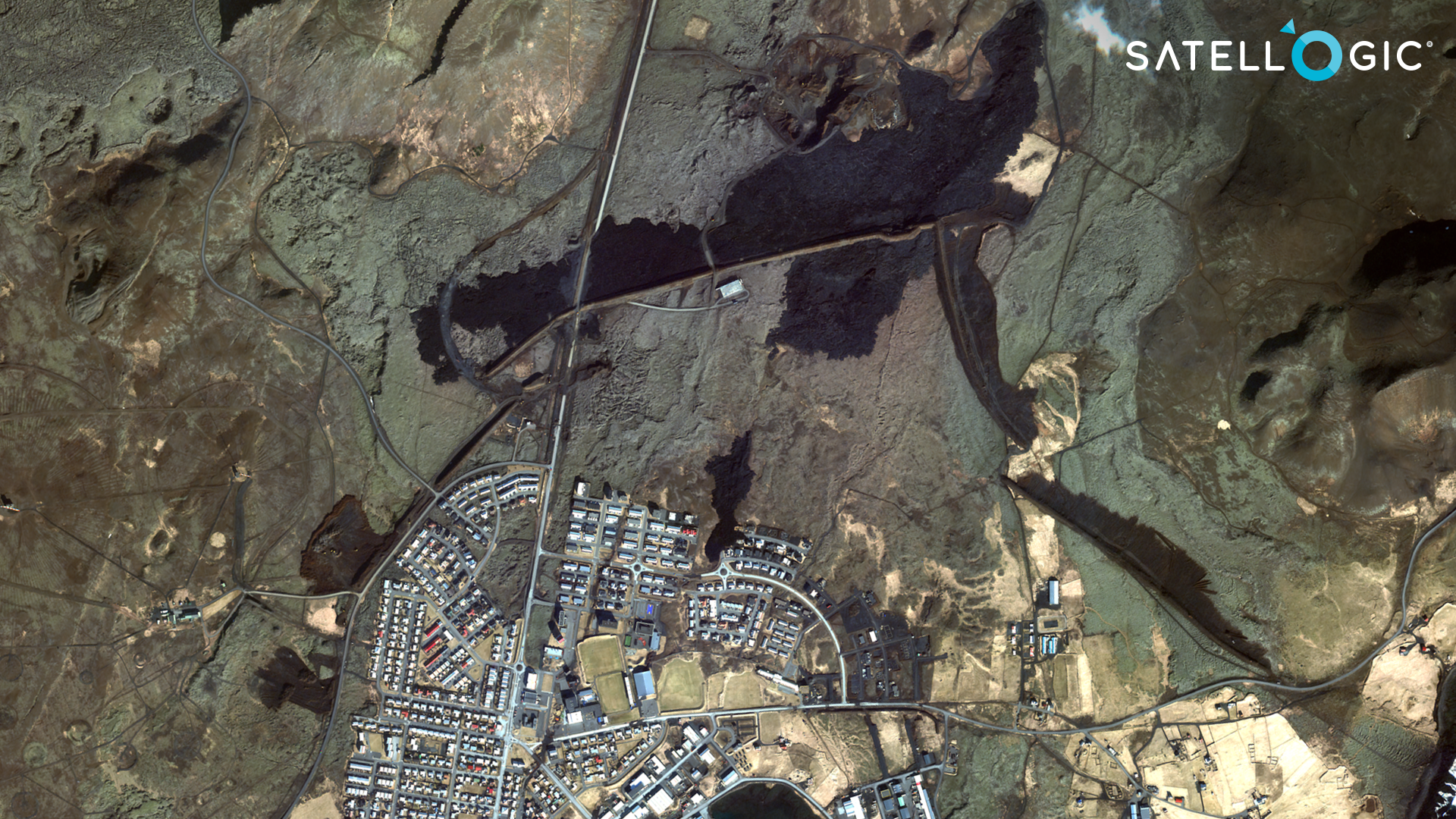
The before-and-after visualization above compares pre-eruption captured on November 30, 2023 (left) and post-eruption images from March 11, 2024 (right), revealing the extent of damage. In the post-eruption, lava surfaced near Grindavík town, impacting at least five buildings and streets. Additionally, the eruption affected the road connecting the town to the northern part of the Reykjanes peninsula.
Optical Satellite Imaging in High Latitude
Optical satellites utilise sunlight for capturing images of the Earth’s surface, where the angle of the sun’s elevation is crucial for exposure. In the winter season, particularly in high latitudes like the Reykjanes peninsula at approximately 64 degrees north in southwest Iceland, there are limitations due to low sun elevation and shortened daylight hours. In Iceland, the maximum sun elevation can drop as low as 3 degrees, with the average daylight duration falling below 5 hours from November to February. The reduced sun elevation leads to longer sunlight travel paths and atmospheric scattering, often resulting in darker and sometimes unusable images. Additionally, the shorter daylight hours limit opportunities for image collection, prolonging the time needed for image acquisition. In certain scenarios, the combination of low sun elevation, short daylight hours, and high cloud and snow coverage during winter may render optical satellite imaging collection impossible.
Despite the limitation, Satellogic’s satellite sensor technology allowed it to capture high quality images in Iceland during the volcano eruption, even though the sun elevation was as low as 2.64 degree on 27 December 2023.
Conclusion
Disaster events are increasing and becoming less and less natural, satellite images have proved to be the best tool to aid in decision making. Satellogic brings a unique satellite technology that provides rapid disaster mapping with very high spatial, spectral resolution and revisit frequency enabling timely emergency response. When integrated with other datasets such as field measurements and SAR data, multispectral satellite images offer an expanded range of measurements to closely monitor volcanic eruptions and other disasters such as floods and wildfires.


