Port Monitoring with AI applied to Satellite images
By HappyRobot, AI agents to automate core business workflows
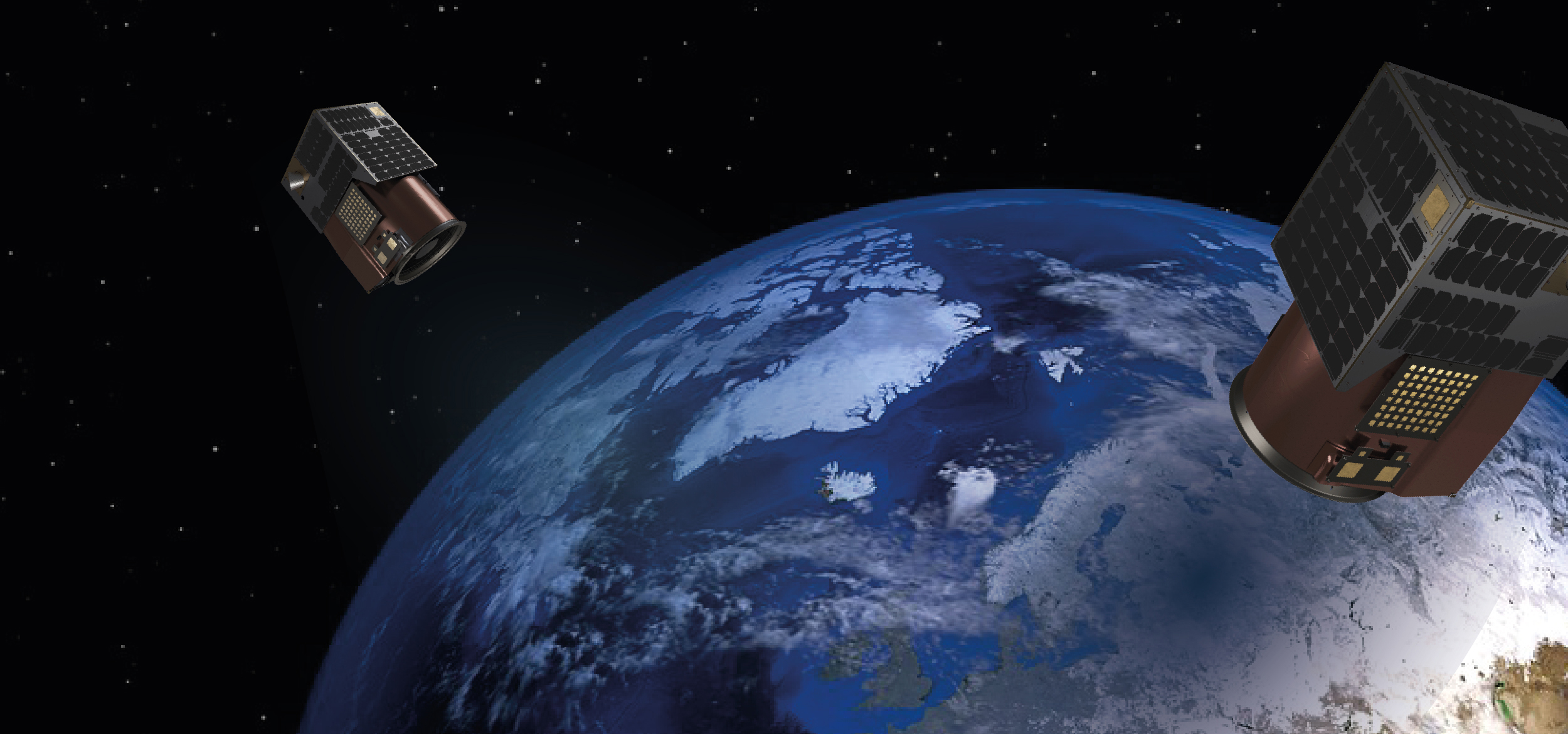
Using satellite imagery by Satellogic, HappyRobot trained an AI model able to identify individual shipping containers and different types of vessels, at any port.
Why Satellite imagery?
Ports are critical hubs in the global supply chain, and their efficiency directly impacts the world economy. However, tracking and analyzing port traffic, particularly the number of shipping containers and boats, can be a daunting task due to the sheer scale and complexity of operations.
Satellite imagery offers a real-time alternative for counting containers effectively. It also ensures consistent data across different ports and captures all visible containers, including those in transit or stored outside designated areas, providing great data to be plugged in forecasting algorithms.
However, shipping containers are just a couple of meters wide, which makes them impossible to find on low-resolution satellite imagery (3-5 m and above).
Satellogic affordable, High-Resolution Imagery to the Rescue
With the advent of high-resolution imagery at affordable prices, tasks like identifying shipping containers from the sky are becoming increasingly feasible. We partnered up with Satellogic, a leading provider of high-resolution satellite imagery, and leveraged their 70 cm resolution and super resolution products to tackle this challenge.
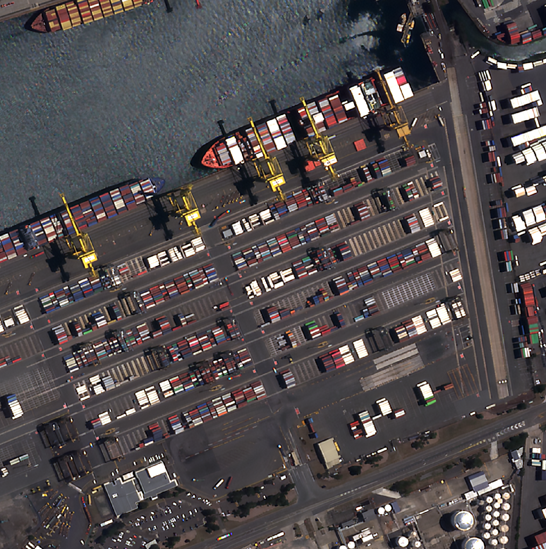
With this resolution, shipping containers can not only be individually identified but also analyzed by size.
Building a Shipping Container Detector in Hours
At Happyrobot we’ve built an AI tool which unlocks the analysis of large amounts of satellite imagery in hours. We leverage the most recent advances in Computer Vision and Foundation Models to build custom object detectors from only a handful of training examples. In this case study, we were able to train an AI model to identify individual shipping containers with high accuracy.
Happyrobot’s AI model training tool allows you to build an object detection model with just a few clicks, simply by providing a few positive and negative examples per class.
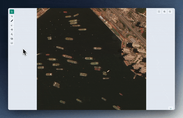
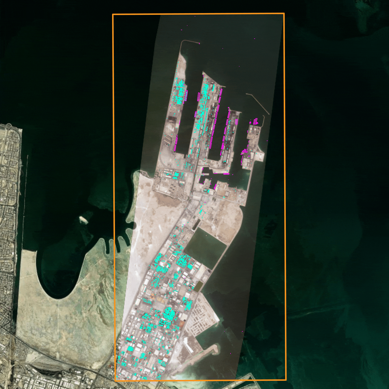
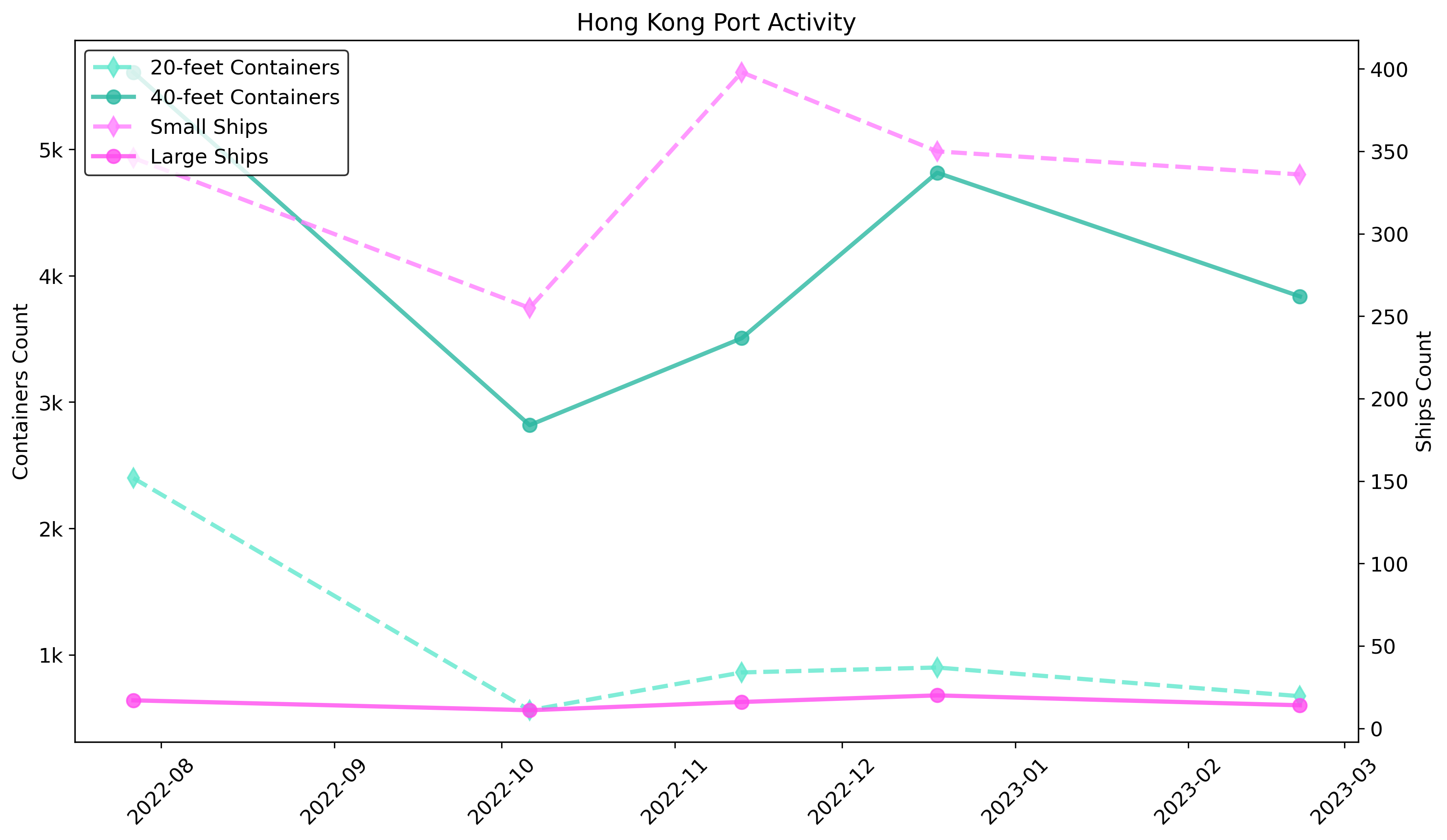
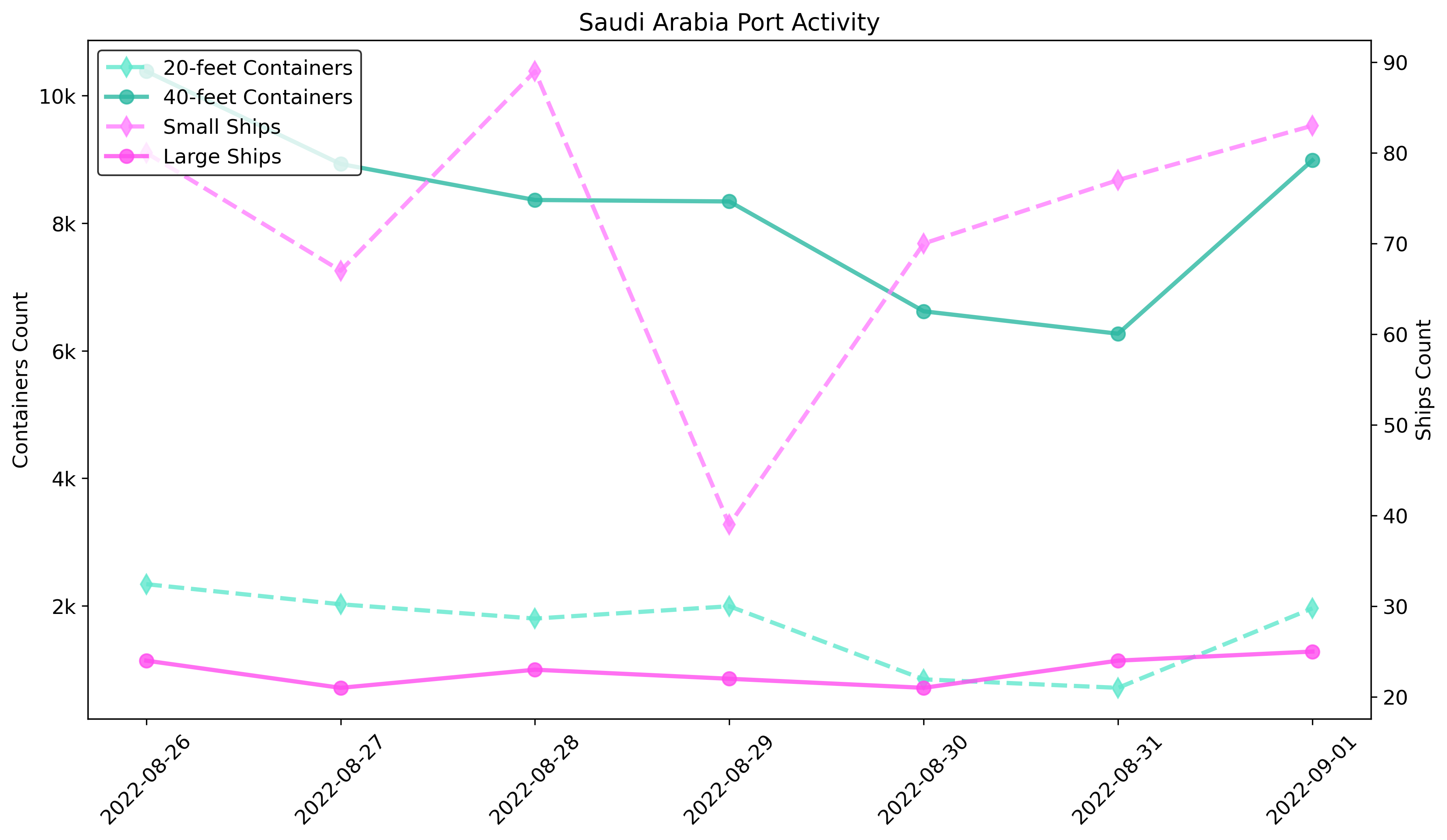
Once we trained the model on how shipping containers look like, we applied it to the entire ports of Hong Kong and Saudi Arabia over the course of different weeks. The model identified and counted the shipping containers across different dates, providing us with a time-series dataset of the number of containers in that particular port.
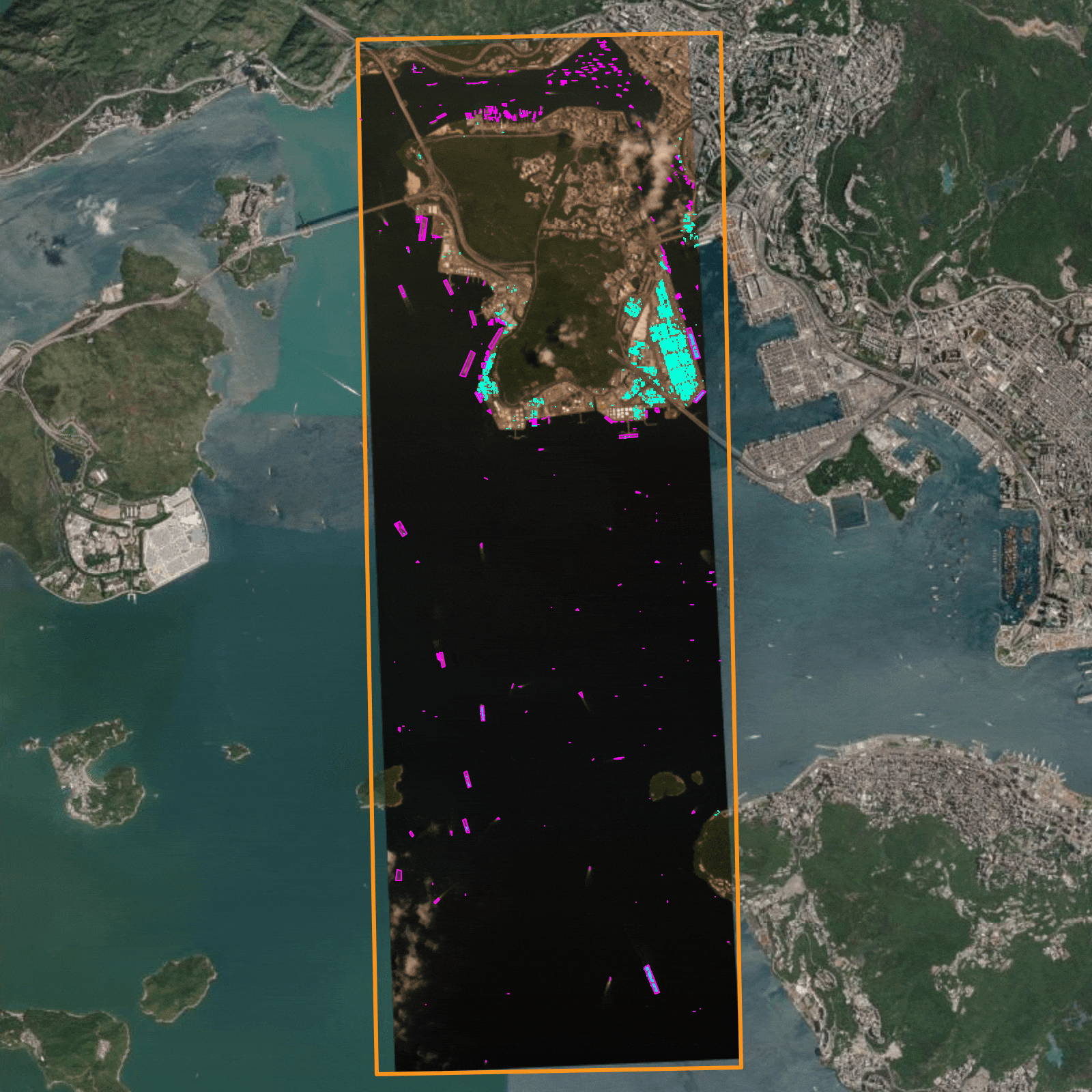
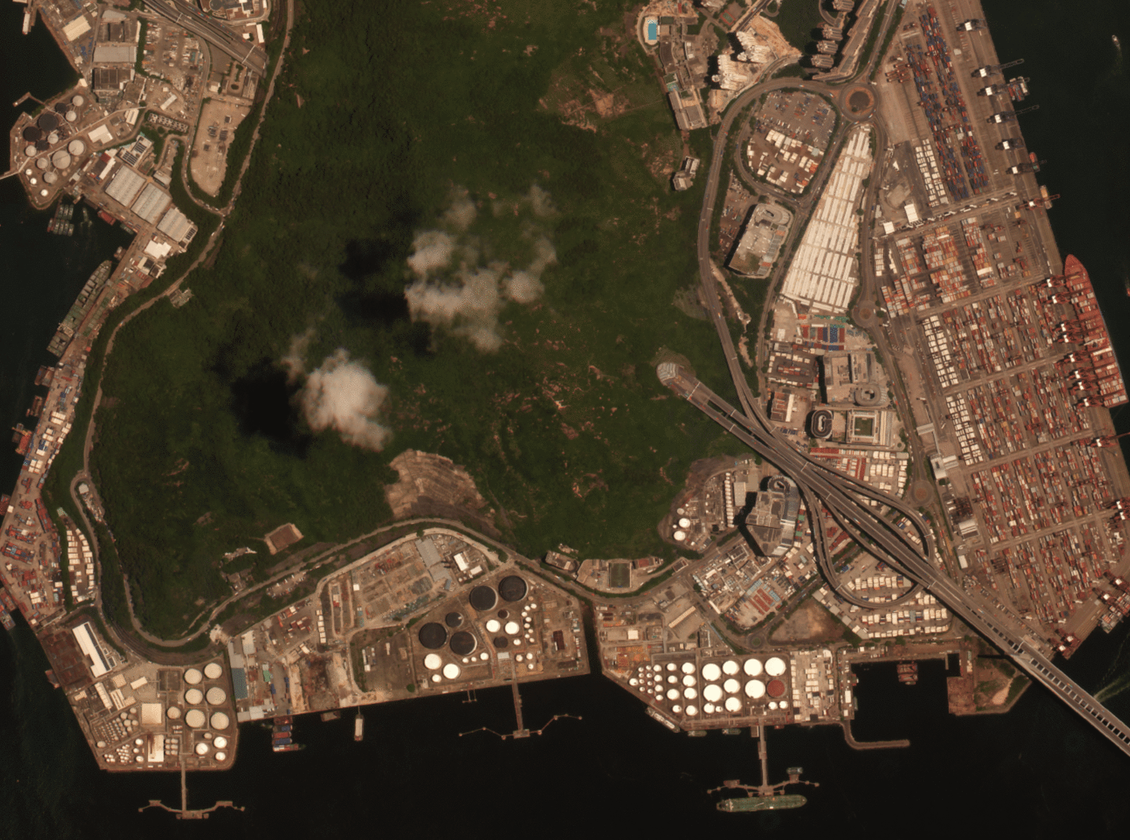
By selecting an area of interest, such as the port of Hong Kong in this picture, and leveraging Satellogic’s high resolution combined with Happyrobot’s AI models, we were able to monitor port activity over several days.
Counting visible shipping containers is an excellent proxy for gauging port activity and tracking its changes over time.
In this image, we demonstrate how we monitored it at a port in Saudi Arabia.
Impressive results
Our approach allowed us to count visible shipping containers and vessels with an accuracy rate of 90%. This high level of precision was consistent across both ports we monitored, regardless of their size or the density of containers.
With Satellogic’s 0.70 cm resolution imagery, AI models can be trained to identify a wide range of objects and even distinguish between different classes of the same object, such as types of vessels or sizes of containers.
Monitoring trading fluctuations from satellite imagery
Happyrobot’s object detection models can monitor changes over time and can be integrated with forecasting algorithms or other analytics.
Impact and Future Applications
This project demonstrated the power of combining affordable, high-resolution satellite imagery with advanced machine learning techniques. The insights gained from this study can be used to optimize port operations, improve supply chain efficiency, and inform investment decisions in the shipping industry.
Looking ahead, we see immense potential in this approach. By expanding the scope of our analysis, we could monitor global trade flows, track specific cargo types, and even predict future port congestion. The possibilities are endless, and we’re excited to continue exploring them with Satellogic.


