Quant Data & Analytics Leverages Satellogic’s 70cm Imagery: A New Era in Geospatial Precision
By Majed Al Hulayel, Lead Data Engineering at Quant Data & Analytics; and David Flanagan, Remote Sensing Engineer at Satellogic
Achieving Cost-Effective Building Detection with High-Accuracy 70cm Data
Quant Data and Analytics, a leading Saudi provider of Data & AI Products and Enterprise Solutions, signed a 3-year agreement with Satellogic in August 2023 with the aim to enhance AI capabilities and analytics for the real estate and retail sectors. Quant shared some initial results that demonstrate the value and application of Satellogic 70cm Earth Observation data.
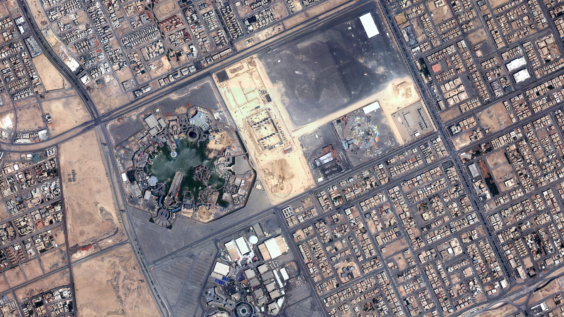
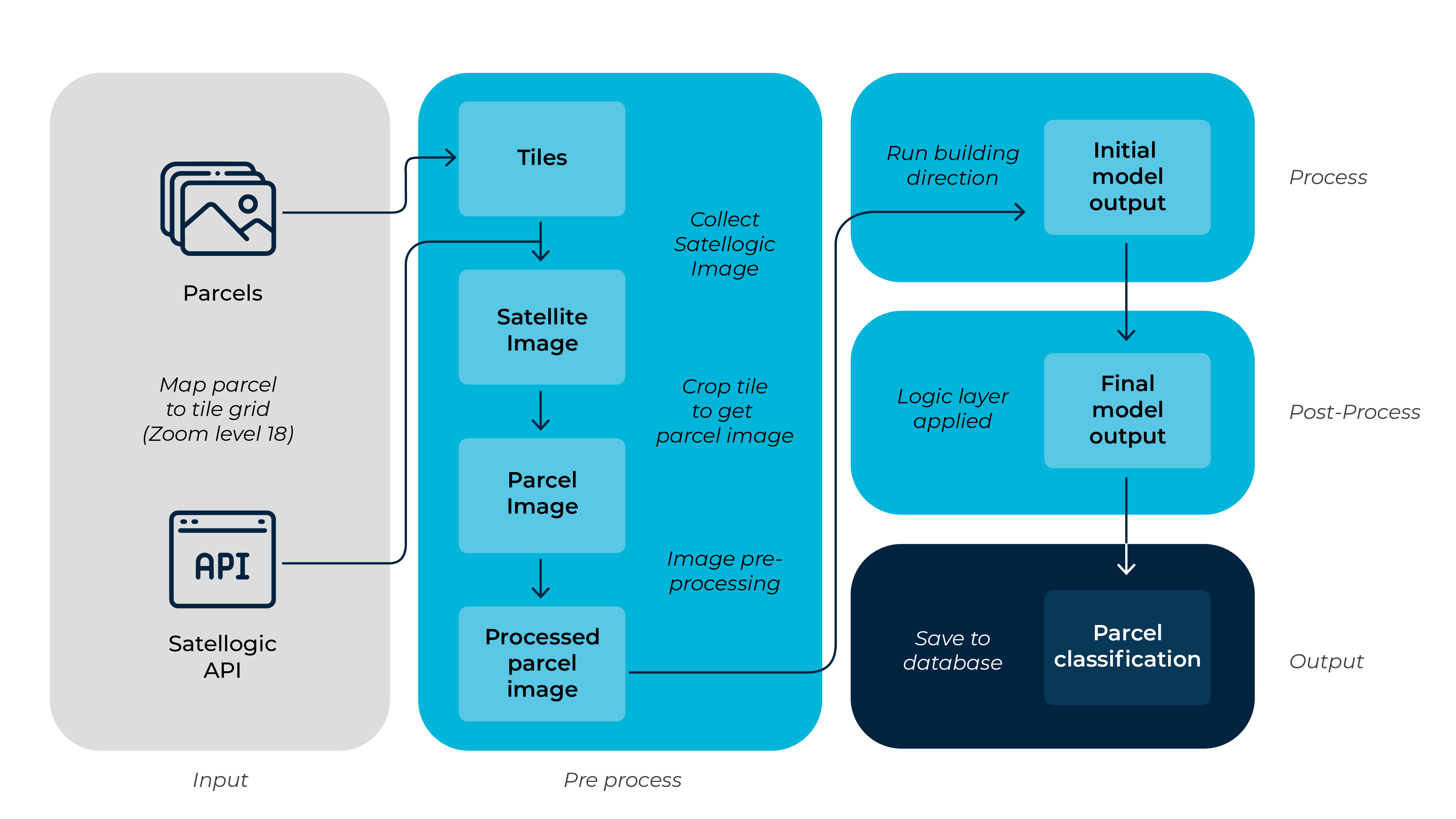
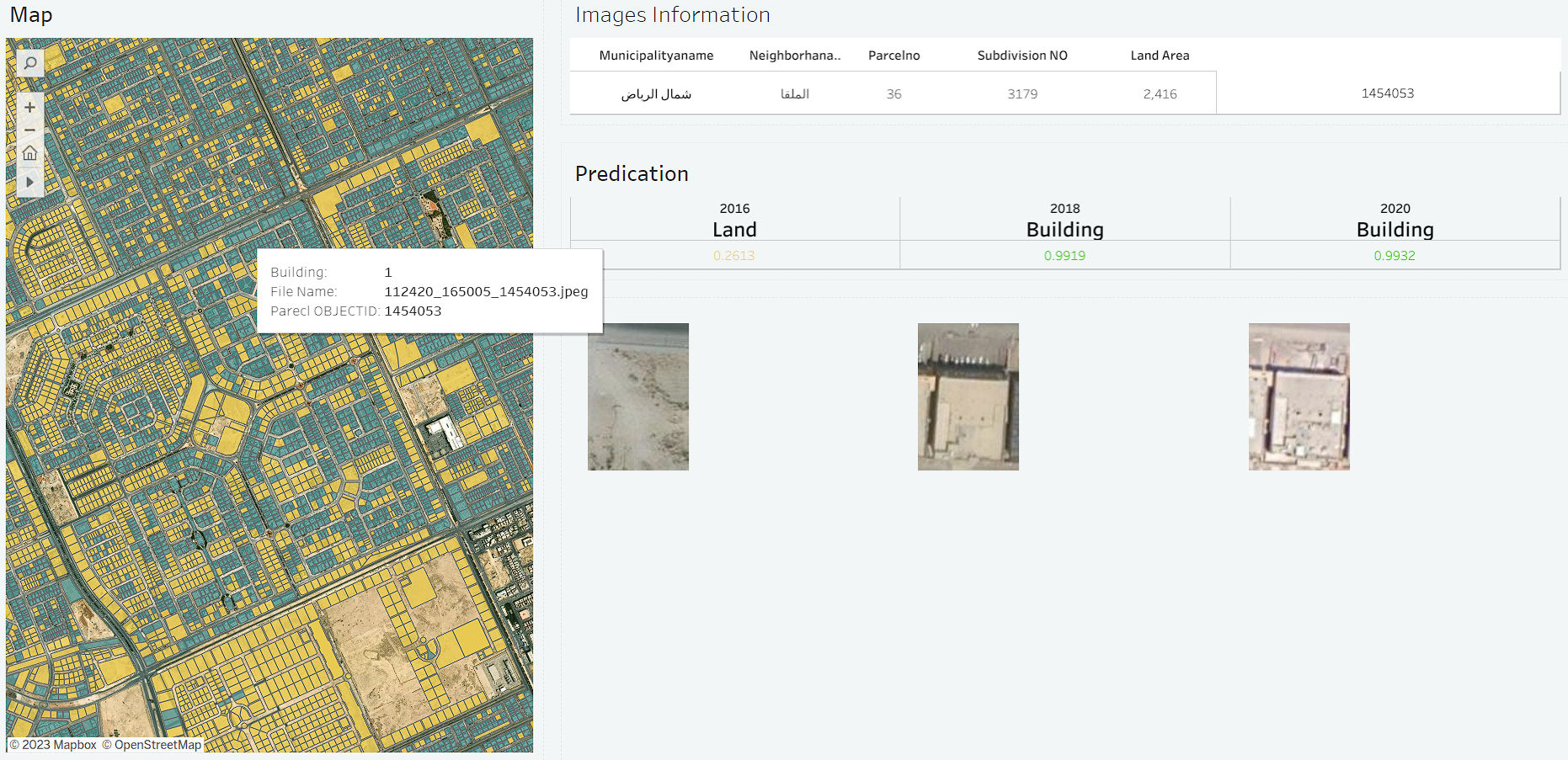
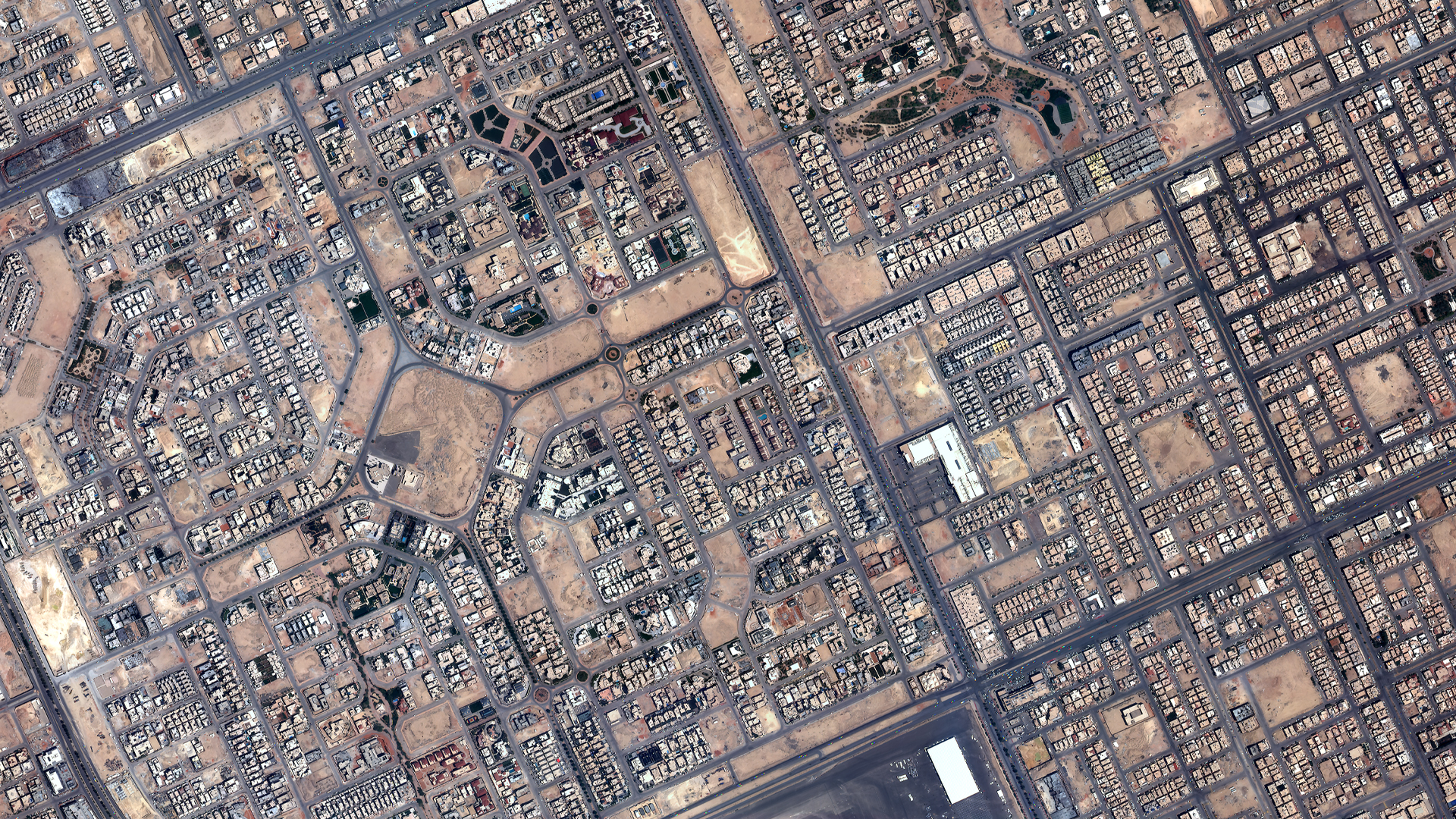
Quant developed a machine learning model to detect buildings using 30cm datasets. Recently, the team conducted a test with the model to compare results using 30cm and Satellogic 70cm EO data, a far more affordable option for high-volume programs. The test was conducted over the Alrabie neighborhood of Riyadh, Saudi Arabia, which consists of nearly 5,000 different parcels of land.
The test results revealed a high compatibility rate between the 30cm and 70cm data, with both sources providing accurate building detection for 97% of the parcels analyzed.
| 30cm | Satellogic 70cm | Status | Count |
|---|---|---|---|
| Building | Building | Match | 3920 |
| Land | Land | Match | 897 |
| Land | Building | Not Matched | 84* |
| Building | Land | Not Matched | 74 |
*May be explained by different dates. Satellogic imagery was captured in Dec 2022, whereas the 30cm source was captured in March 2022.
According to Quant, some factors could have influenced the results such as differences in the acquisition dates of the 30cm and 70cm satellite images compared and the training data used for the detection model. More specifically, temporal differences in the imagery could have impacted the final building detections causing the discrepancies in the results. Also, the model employed was originally trained using 30cm imagery, which when applied to 70cm data may have introduced some biases.
Ultimately, this assessment found that there was no significant difference in the ability of 70cm Satellogic imagery and the 30cm imagery to accurately determine land parcel status. If the temporal resolution between the imagery used was more consistent, the model results may have been even more similar. For certain use cases like this one, 70cm imagery is sufficient for estimating the status of land parcels which further demonstrates the value Satellogic brings to the geospatial market by providing high quality satellite imagery at affordable prices.
Satellogic is in the process of collecting more than 650,000 km2 of imagery in Saudi Arabia to aid Quant in deploying their building detection model country-wide. For large-volume users and analytics providers, Satellogic offers more available global tasking capacity than its peers–enabling access to more relevant and more frequent EO data.