Satellogic’s Mark V Satellite: Unit Economics to Enable Foundation Models for Earth Observation
By Emiliano Kargieman, CEO & Founder
Latest NewSat satellite generation capabilities support the future of geospatial AI
In previous posts, I have explored the potential of large AI models in Earth Observation and shared our commitment to advancing this field by releasing an extensive open dataset from our archives to facilitate AI model training. Today, I’m excited to delve into how Satellogic is strategically positioned to establish a recurrent stream of geospatial data covering the globe, cost-effectively.
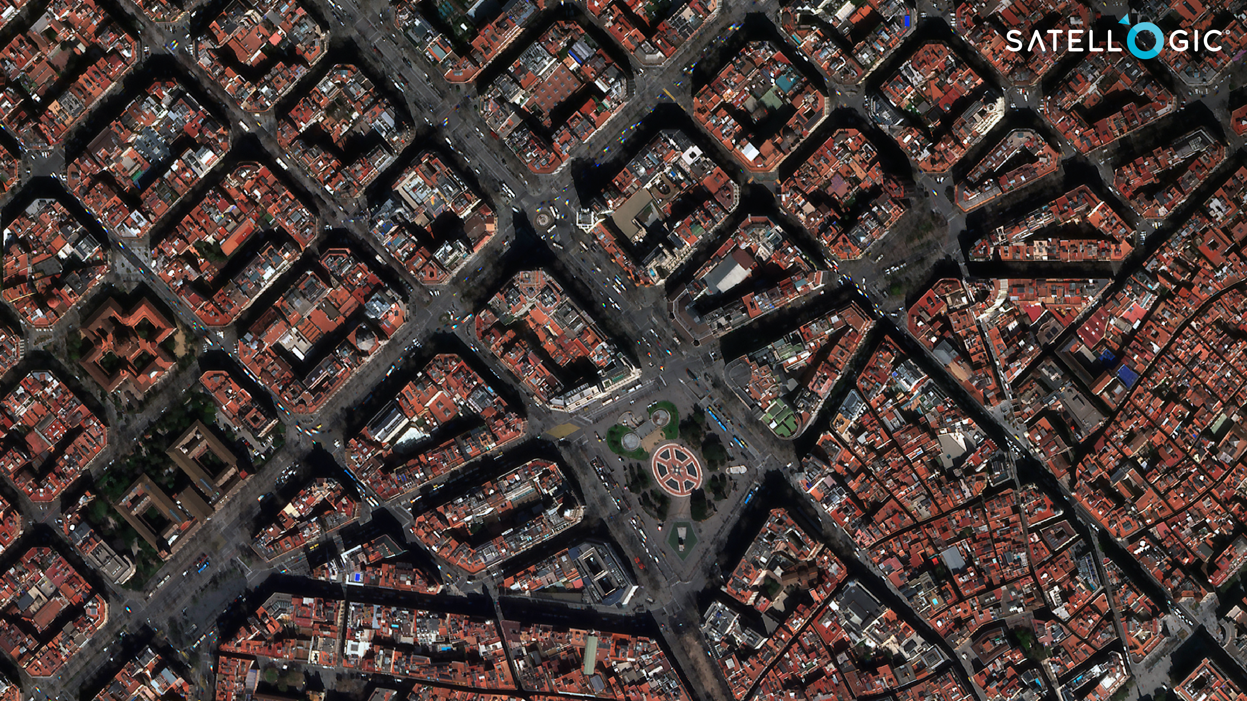
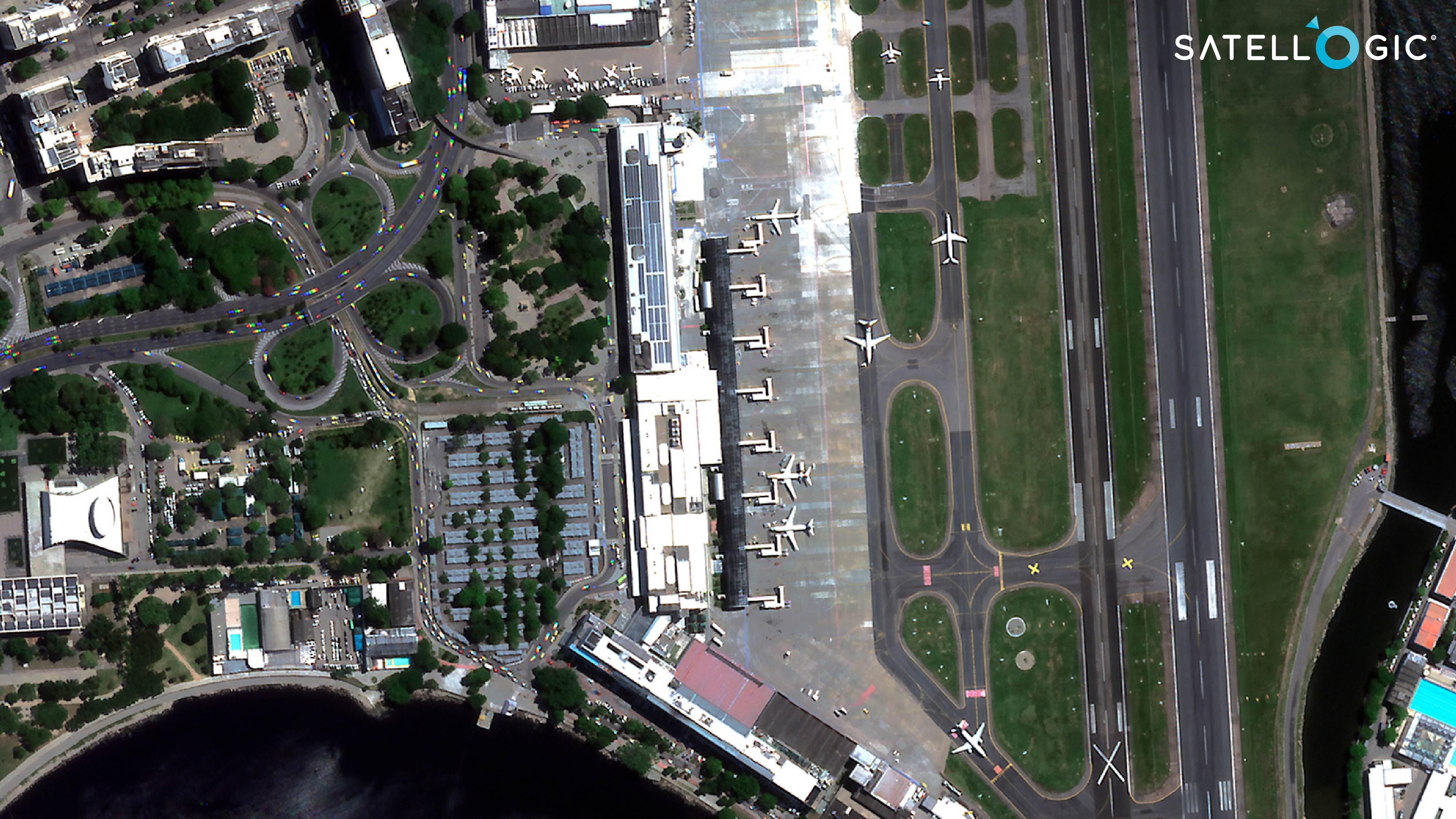
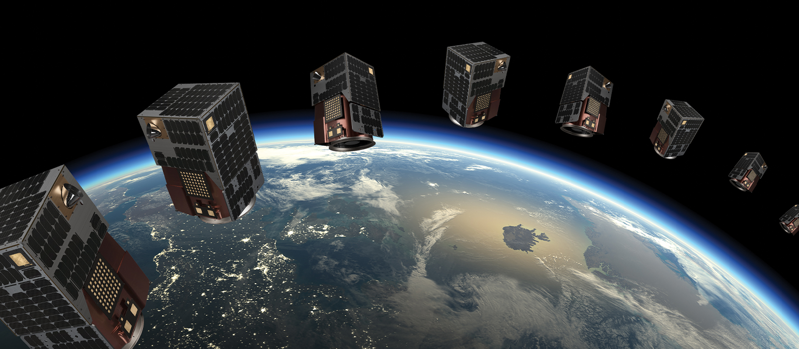
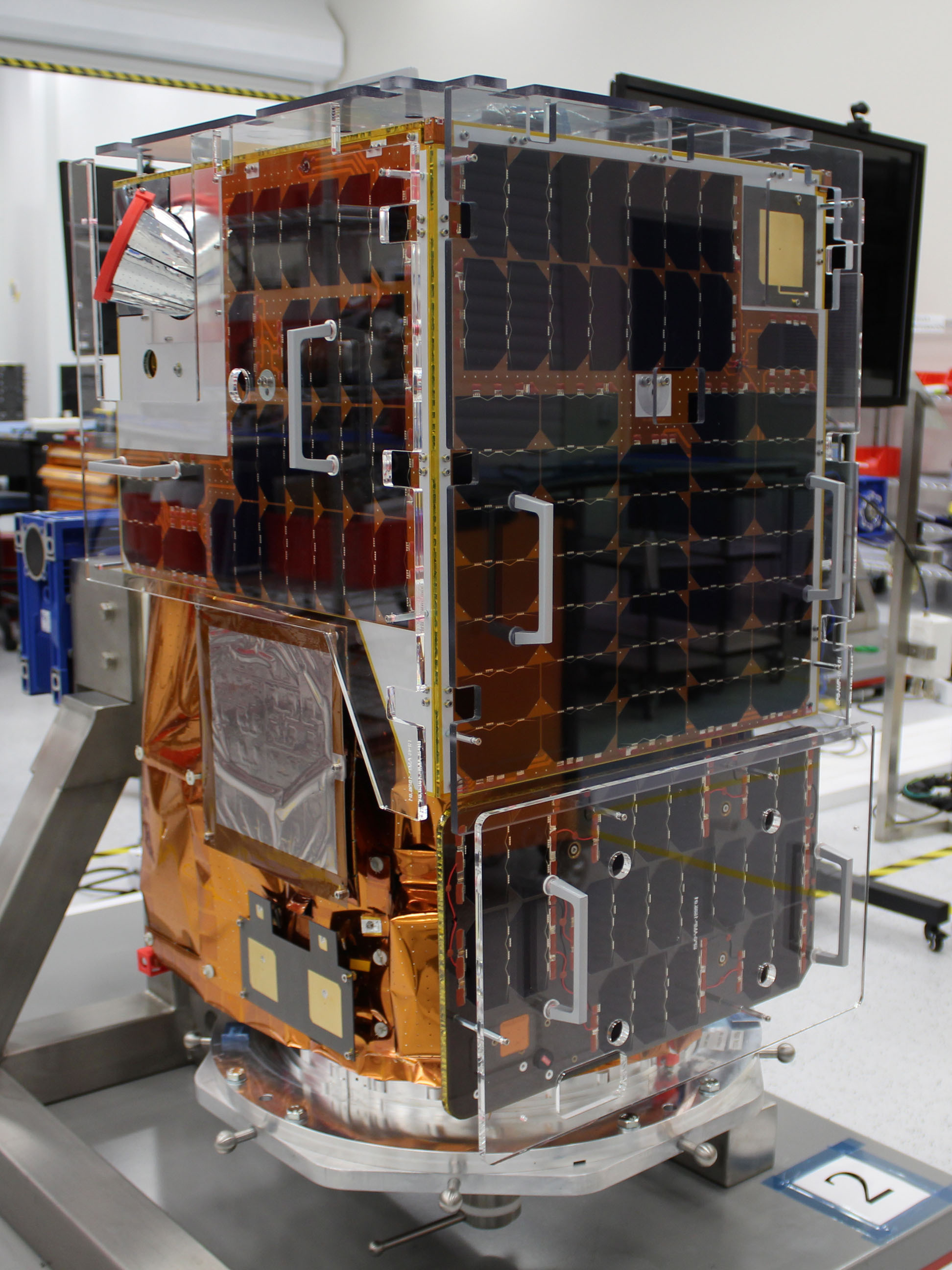
Satellogic is now deploying its latest satellite series, the Mark V, building upon the capabilities of its predecessor, the Mark IV. This transition signifies an advancement in capturing high-resolution imagery economically, facilitating frequent future updates of Earth’s surface. These satellites address the ongoing need for high-resolution geospatial data, which is critical for the development of visual language models for Earth Observation.
The Mark V satellites also possess onboard computing capabilities, allowing them to execute AI algorithms that extract desired insights from the captured imagery while in orbit, eventually running parts of a Visual Language Model on-board. This feature facilitates faster data downloads, allows for utilizing links not exclusively dedicated to imagery transmission, and enables real-time alerts. (For more info please refer to Satellogic’s paper “An empirical study of applying AI on the edge for Earth Observation”).
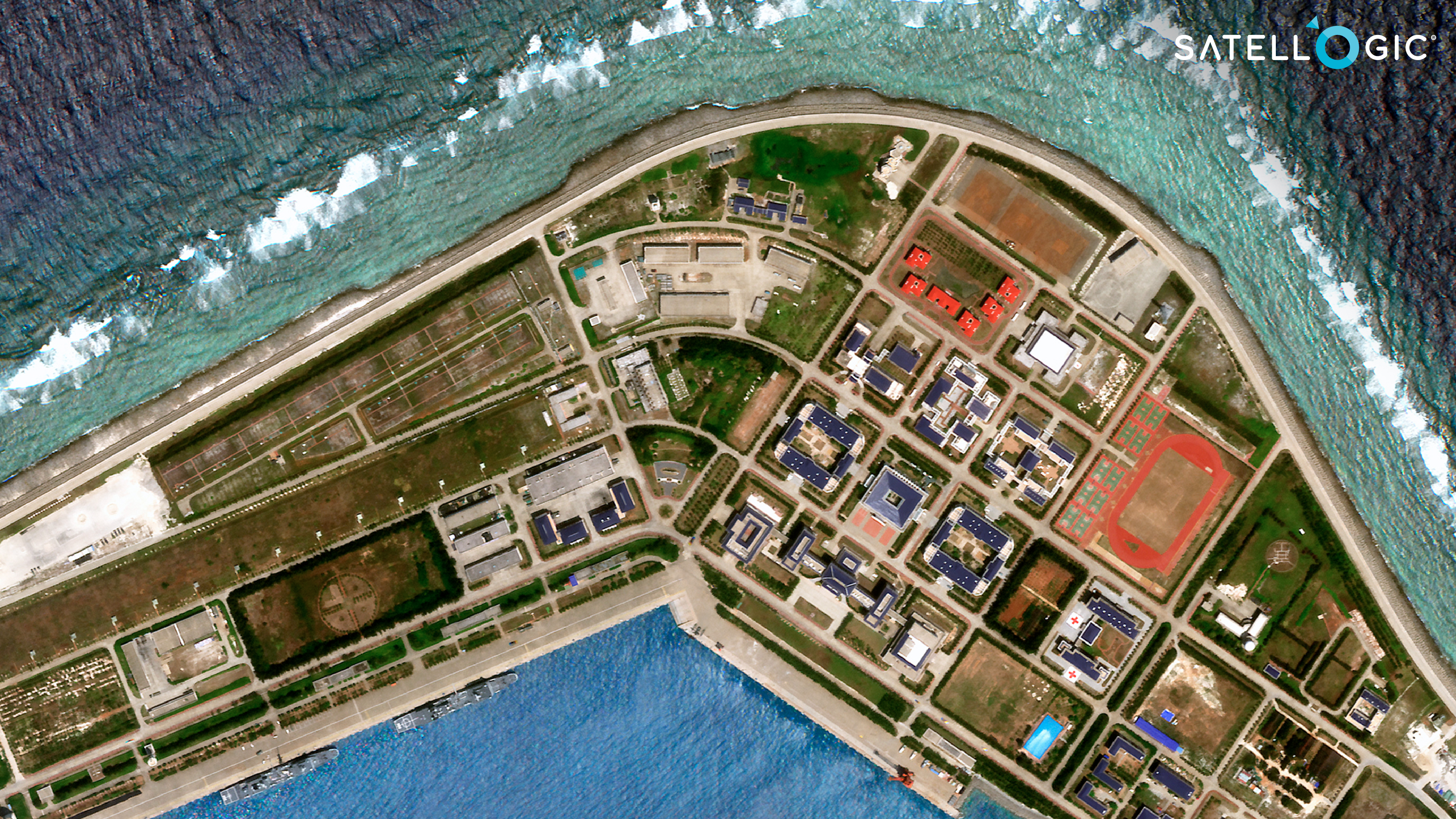
Subi Reef, Spratly Islands

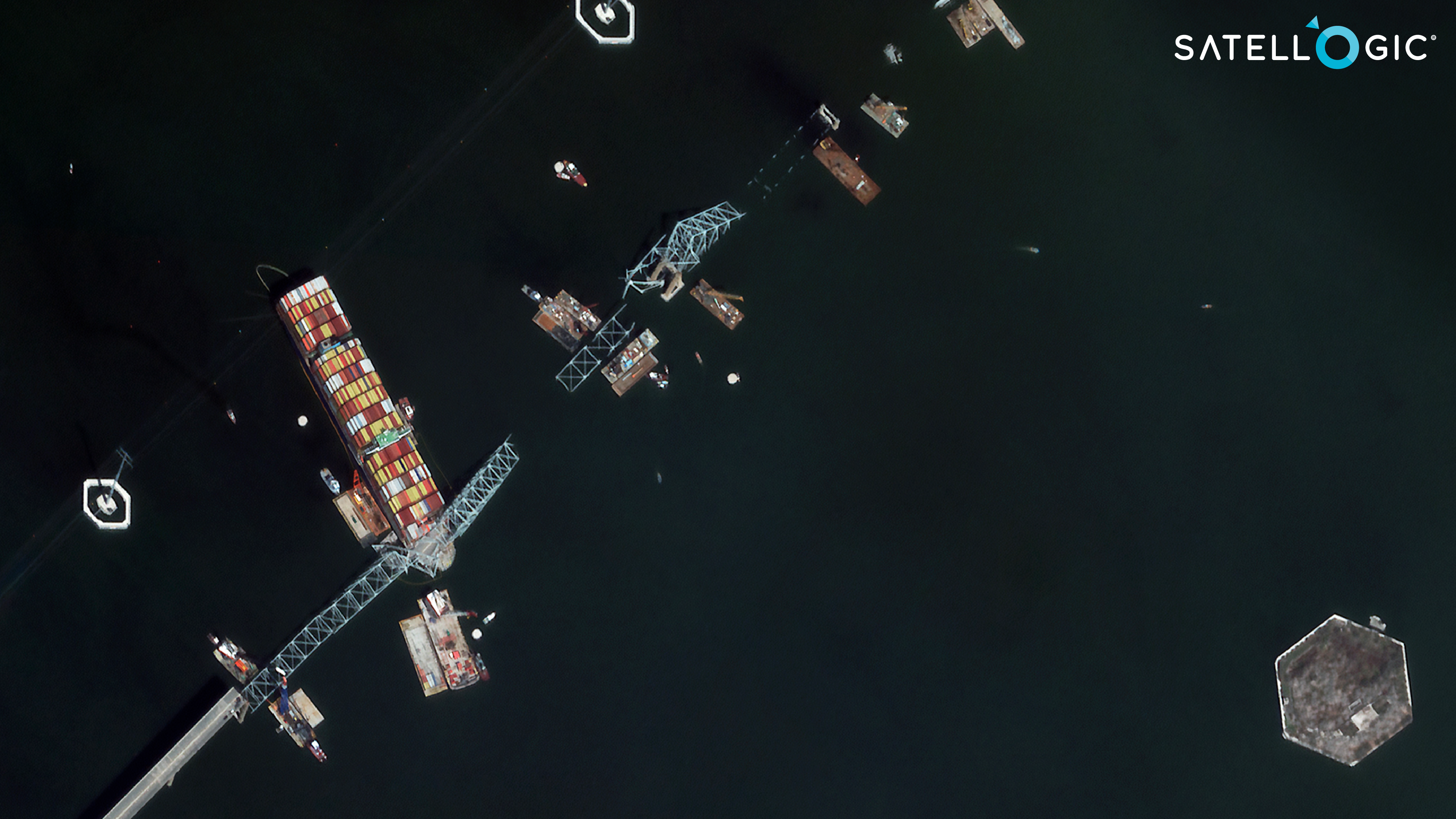
Tianjin port, China
Francis Scott Key Bridge, Baltimore, MD, USA
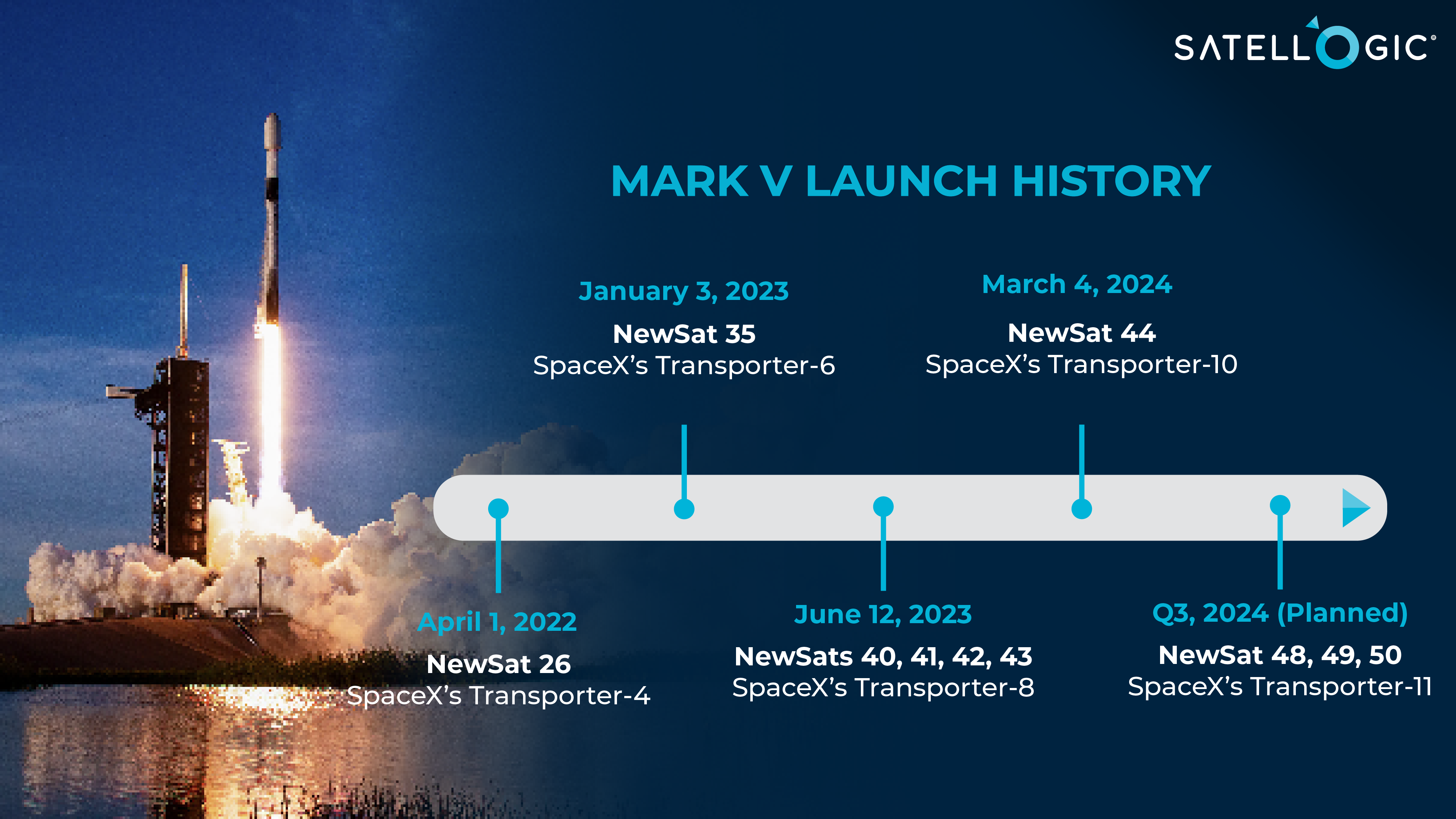
Testing and deployment of the new Mark V satellites commenced in 2022. To date, seven Mark V satellites have been launched, with the more developed Mark V-c models already generating imagery. With current facilities, Satellogic can manufacture at a rate of up to 4 Mark V satellites per month.
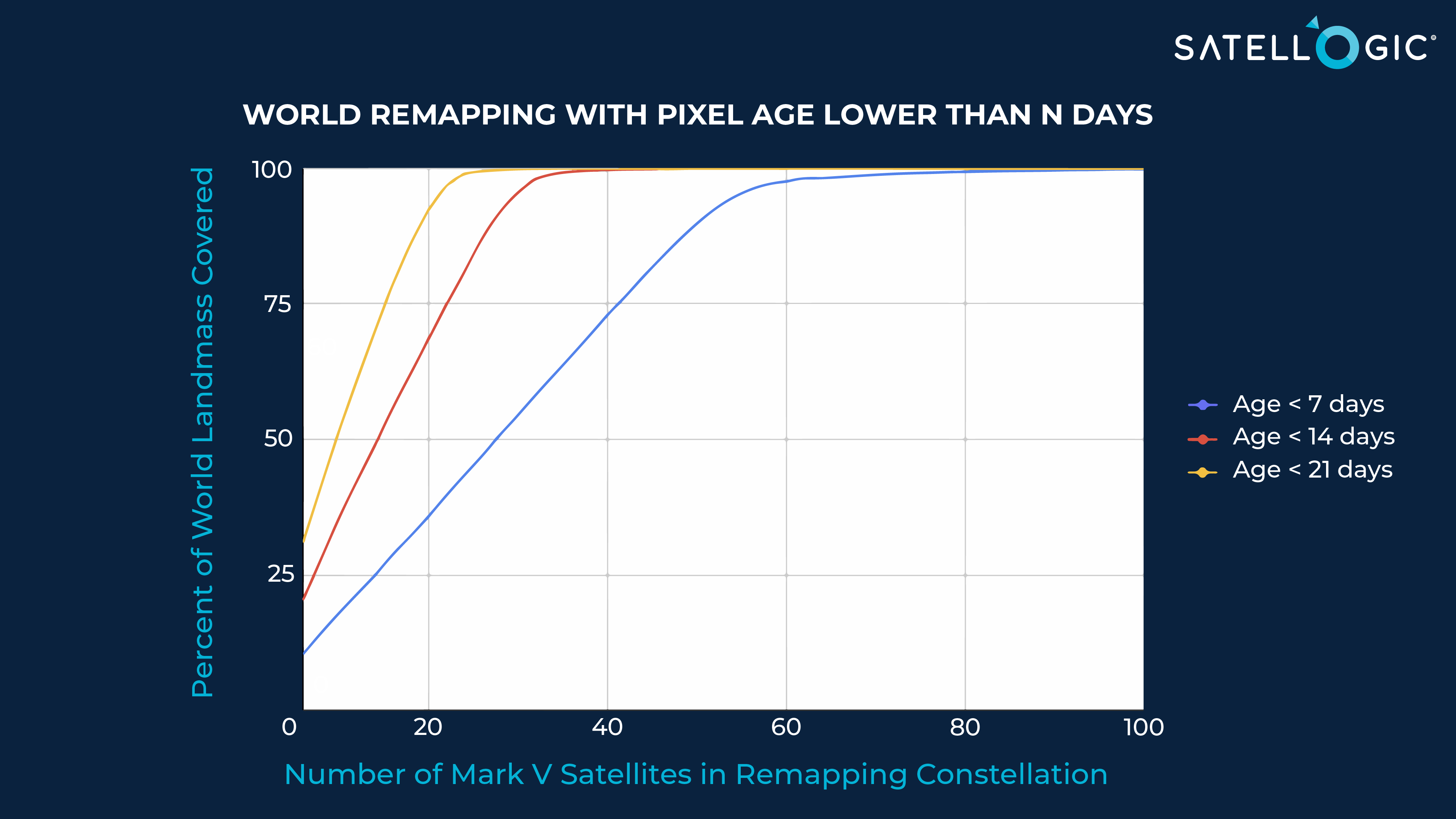
Mapping the Earth’s landmass with Satellogic’s Mark V satellites requires balancing three key factors: the quantity of satellites, desired frequency of remapping, and the percentage of landmass covered. As illustrated in the chart below, utilizing 24 satellites already enables remapping of over 80% of the world’s landmass every two weeks.
Satellogic’s Mark V satellites are notable for their attractive unit economics. With a projected design life of up to 5 years, they aim for an anticipated capex cost of less than $0.002 per square kilometer. In contrast, competitors providing high-resolution imagery face significantly higher unit economics, often by two orders of magnitude. When factoring in the satellite specifications and costs of competitors, their capex for worldwide remapping would amount to two or three orders of magnitude higher than those of Satellogic.
Satellogic’s Mark V satellites offer a practical means of gathering high-resolution imagery data for advancing AI-driven solutions. Imagine the potential of recurring high-resolution geospatial data combined with related foundation models. Remarkably, this is achievable now, as we possess the ability to develop the models and generate this type of geospatial data affordably.
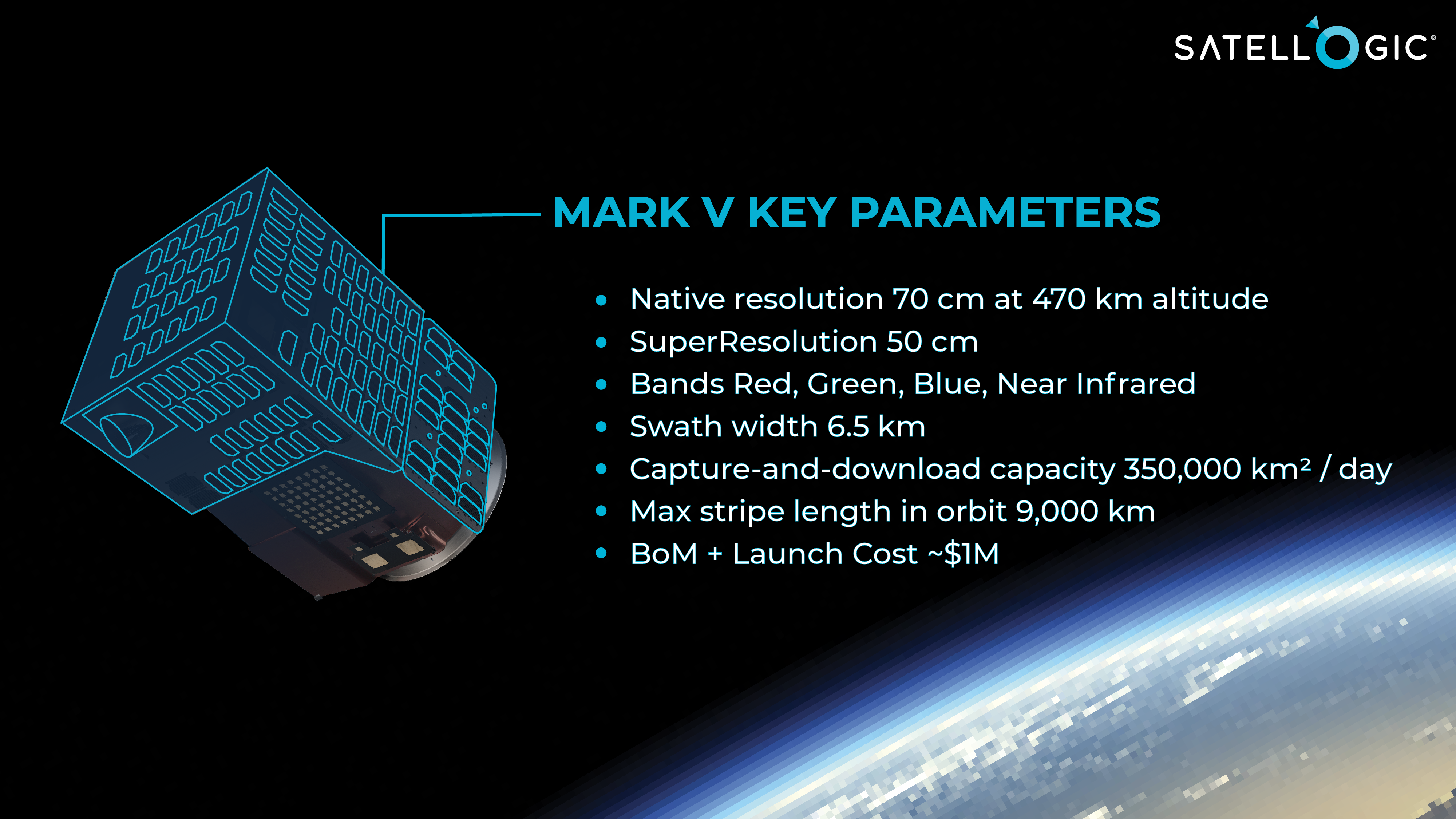
Satellogic NewSat Mark V