Streamline access to Satellogic’s open dataset with EarthView Viewer
By Gerardo Richarte, CAO & Founder
Use Satellogic’s open-source EarthView Viewer and library to access its high-resolution imagery dataset for AI model development.
Building on our previous update regarding the release of a comprehensive open dataset of high-resolution imagery from our archive, we’re pleased to introduce EarthView Viewer. This open source application and library offers a user-friendly platform for accessing and exploring this rich data resource. Anyone can now easily take advantage of EarthView Viewer to delve into the details and enhance their AI model training endeavors. In conjunction, we are releasing a python library that simplifies access to the dataset and its images.
- Dataset Viewer: https://satellogic-earthview-viewer.hf.space/
- Dataset Information: https://hf.co/datasets/satellogic/EarthView
As described previously, the dataset comprises approximately 3 million Satellogic images of unique locations, totaling 6 million images including revisits. The dataset released integrates Satellogic archive data at 1-meter spatial resolution with data from Neon, Sentinel1, and Sentinel2, each possessing distinct characteristics. The new Earth View Viewer and library facilitate seamless exploration by unifying formats and enhancing accessibility to the dataset.
- Satellogic data is released under a Creative Commons CC-BY 4.0 license, allowing for commercial use of the data with attribution.
- The viewer’s code is available on HuggingFace under an MIT license, and can be modified freely.
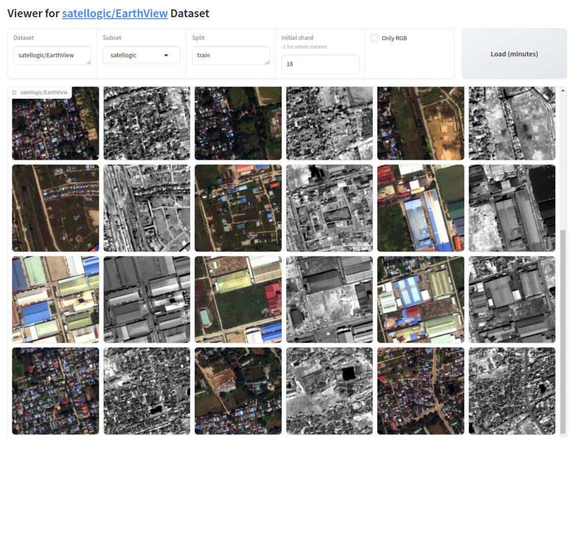
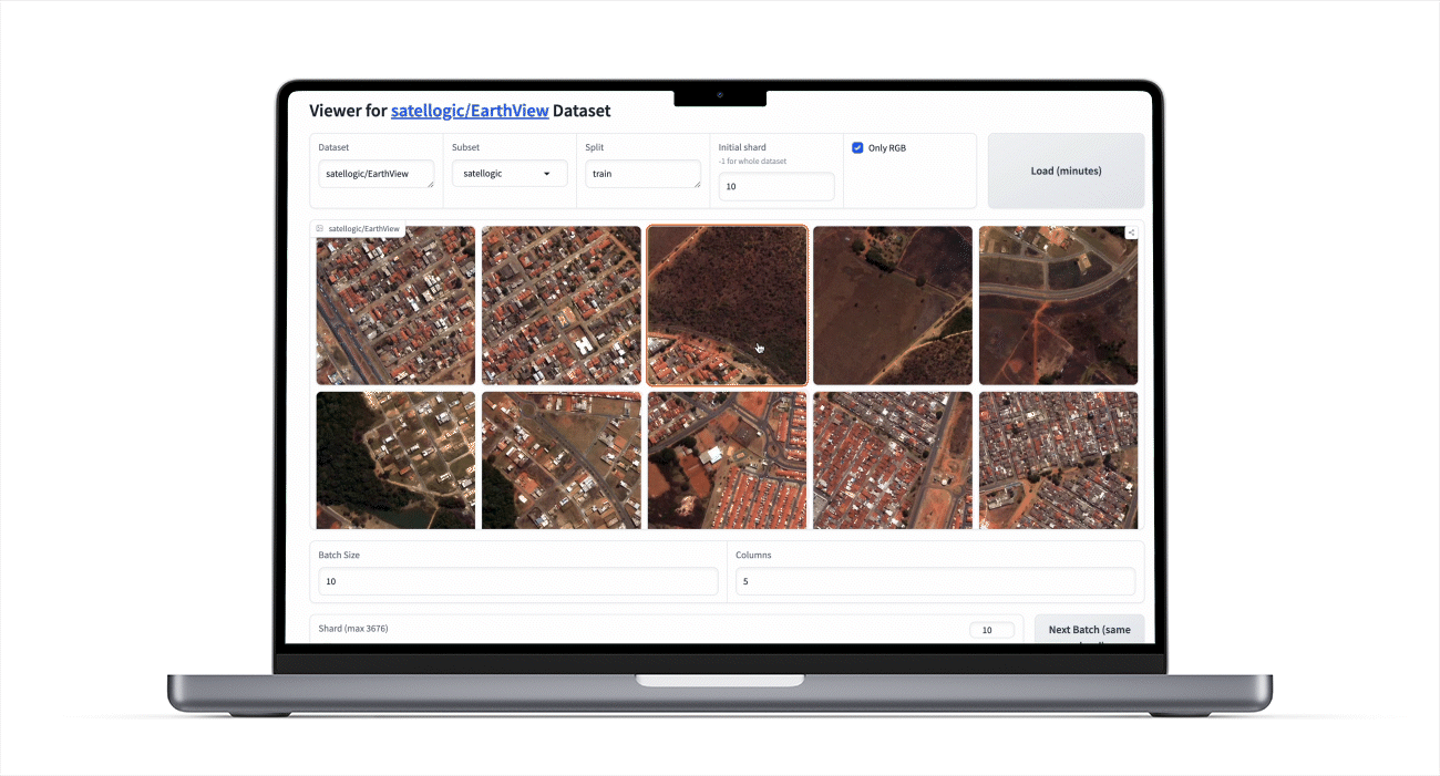
EarthView screenshot. Satellogic imagery. RGB and NIR
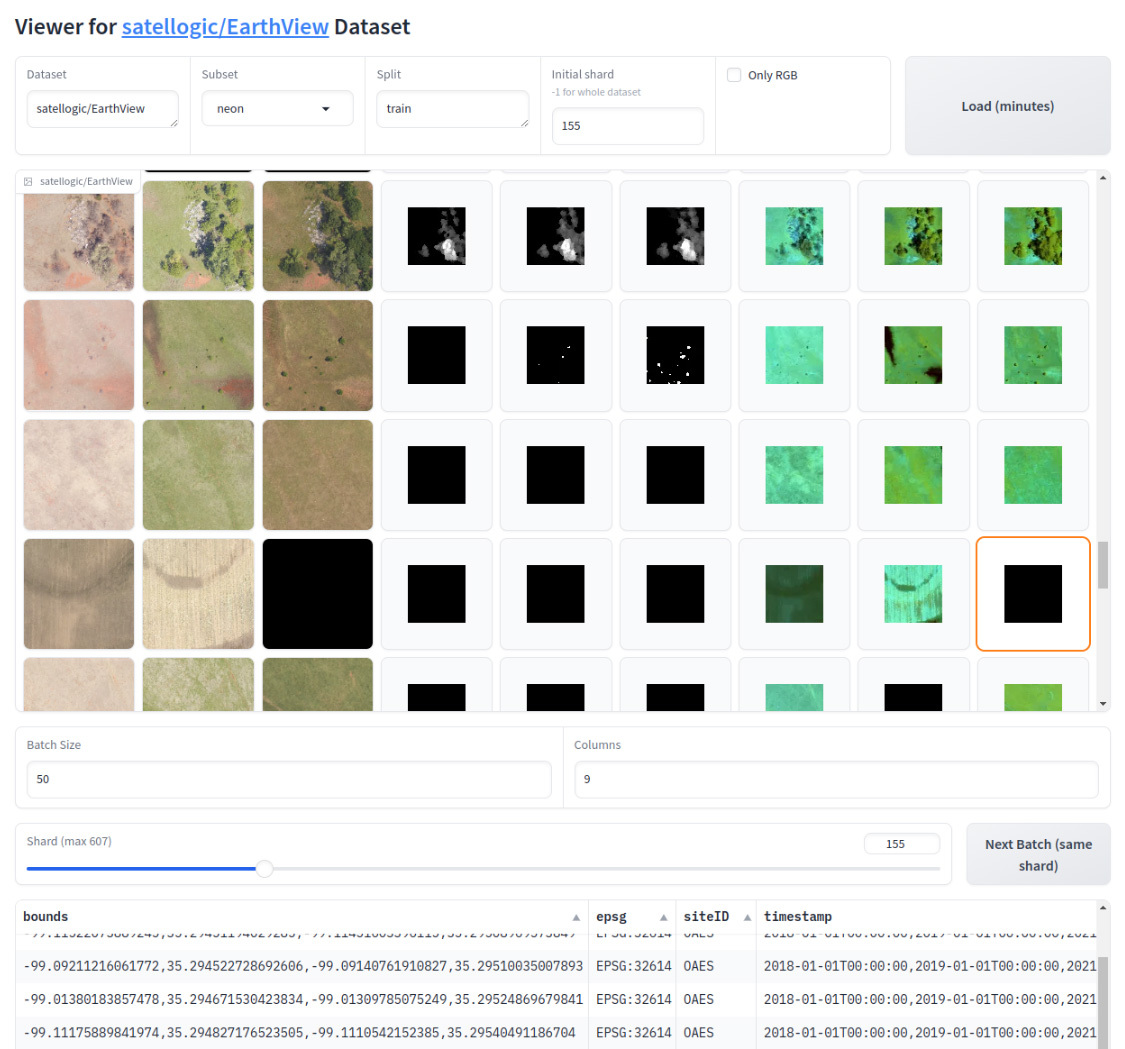
EarthView screenshot. Neon imagery. RGB, CHM and Hyperspectral
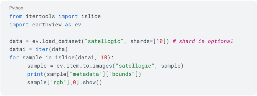
The library, earthview.py, is in the same code repository as the viewer. Usage examples can be found in the dataset readme. As an example, next code below opens and shows a single one image from the Satellogic dataset:
With the dataset, viewer and library, our goal is to support people interested in developing and improving AI models for Earth Observation imagery, and foster the development of specialized VLMs for this data.


