
National Parks: Earth Observation Data as a Vital Tool for Conservation
By The Satellogic Team
EO data for monitoring and protecting biodiversity and natural resources
National parks are essential for preserving biodiversity and natural resources, but managing and protecting these areas can be challenging. While research from almost two decades ago suggested that, in the following years, protected areas in developing countries would face underfunding to the tone of billions of dollars, more recent studies from vast protected areas — such as the special areas covering certain African savannas, to mention an example — corroborated that these natural spaces still have to grapple with budgetary obstacles. Likewise, a IUCN paper from 2019 revealed that only a quarter of surveyed protected areas had adequate resources, staffing or budget.
But, even among these challenges, protected areas still require care, and traditional monitoring methods, such as aerial photography and ground-based surveys, are important and usual for managing and protecting national parks. However, these methods can be costly and time-consuming. Earth Observation (EO) data offers a powerful addition to the parks’ data stack, providing valuable information on changes over time, allowing park authorities to make informed decisions about resource management, and ensuring the preservation of these valuable areas for future generations. Thus, accessible, affordable, and scalable EO data offers authorities a further addition to their monitoring methods without representing a grand alteration — or expense — in their monitoring infrastructure or surveying methods.
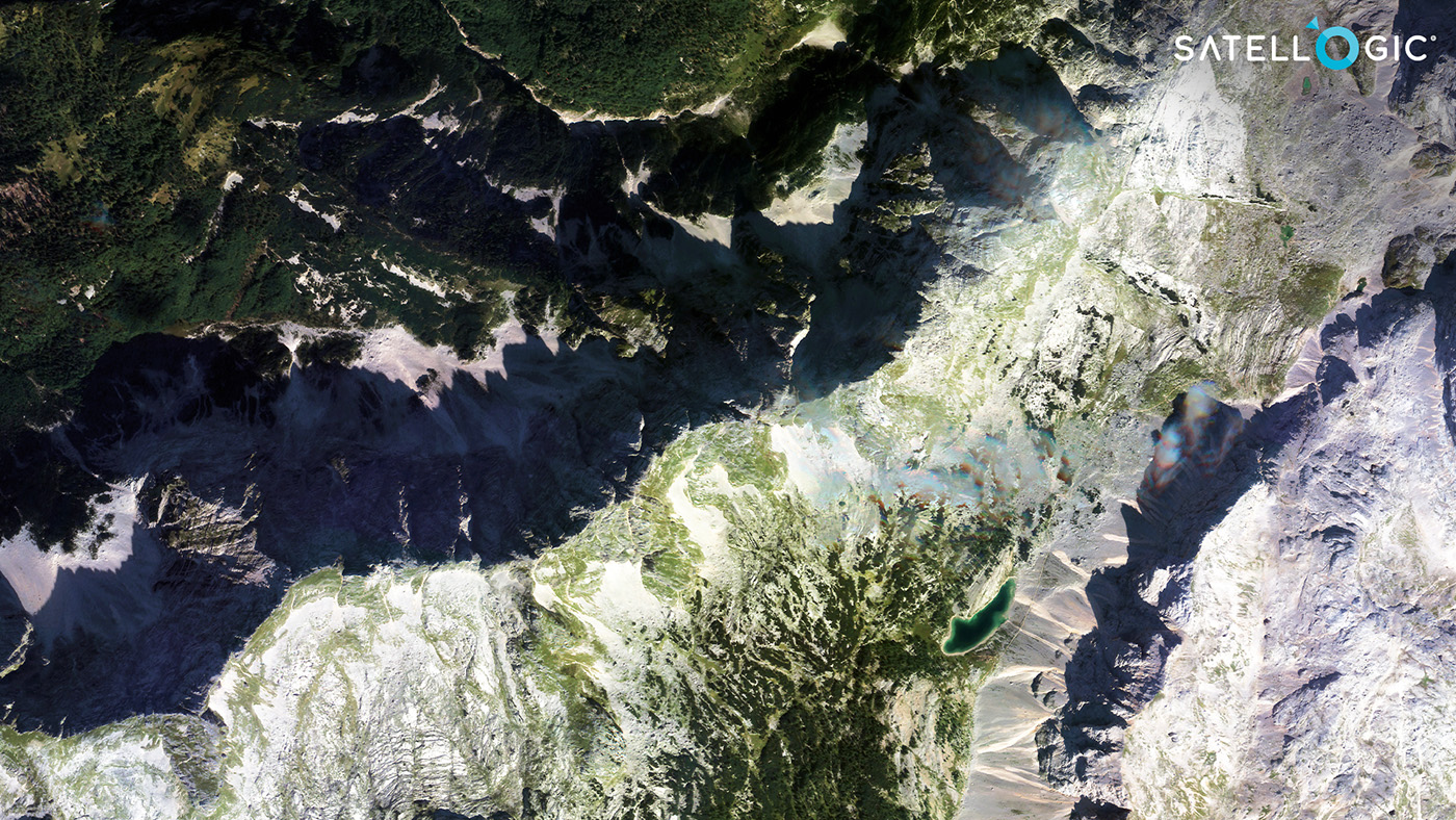
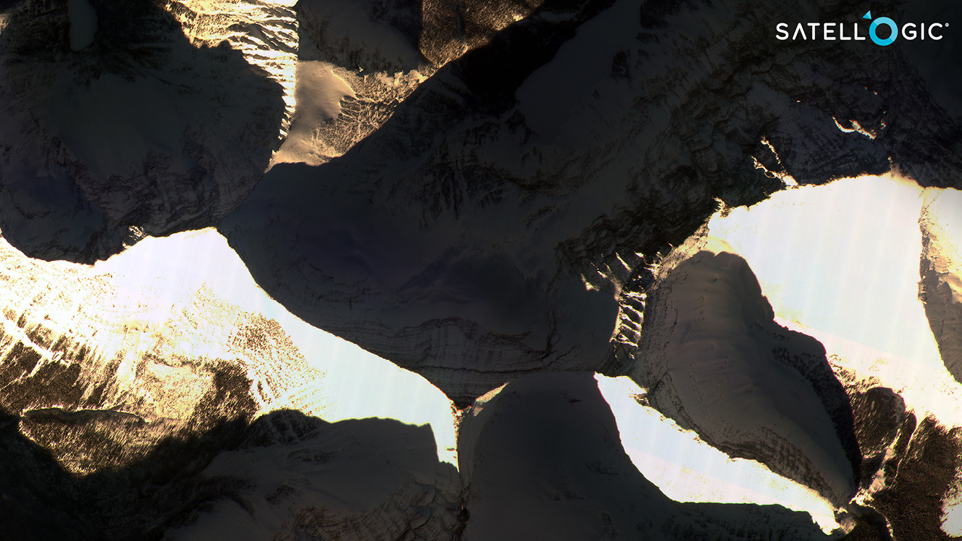
A multispectral capture of the Triglav National Park in Slovenia. Traversed by the Julian Alps, its area is more than five times the size of Ljubljana, the country’s capital city.
Advances in EO data, including improvements in data quality and decreasing costs, offer significant potential for enhancing management and emergency response in national parks. Burned area mapping, damage assessment, and monitoring the impact on wildlife and vegetation are some uses for EO data. These resources make it possible for national parks with fewer funds to conduct monitoring and management more effectively and more affordably.
The importance and role of national parks for a sustainable future
National parks as we know them today were first established in the United States in 1872 with the creation of Yellowstone National Park. But scholars suggest that the spirit of conserving areas of our planet has existed for millennia. For example, the world’s second national park, the Royal National Park in New South Wales, Australia, was established in 1879; yet, special engravings hint that, for years before its inauguration, the site had been considered a special place by the Aboriginal culture of the Dharawal.
After the foundation of Yellowstone and the Royal National Park, the term “national park” was adopted by other countries worldwide and has become a standard term for protected areas managed by the government for conservation and recreation.
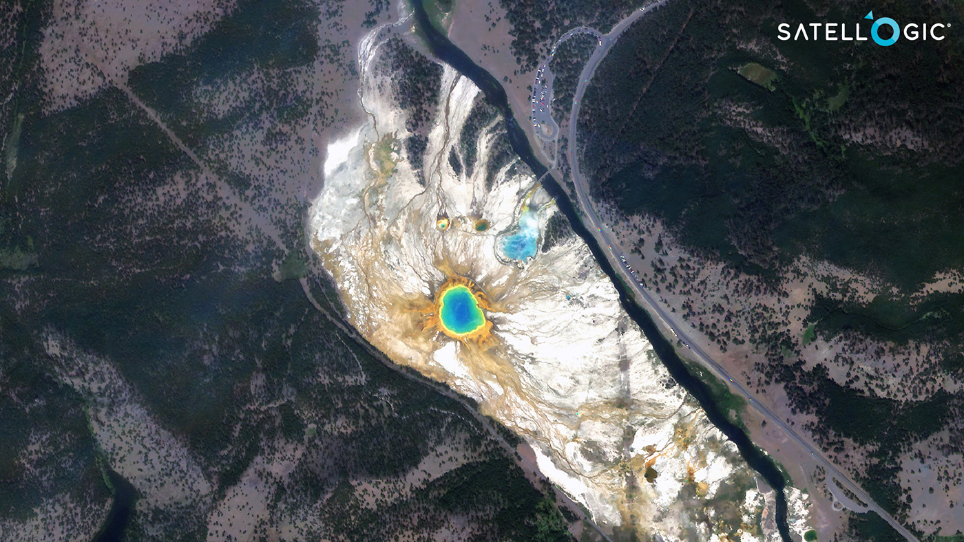
A capture of the Grand Prismatic Spring in Yellowstone, in the United States. The Yellowstone National Park, one of the most famous in the world, also happens to be the first. Earth Observation data can help appreciate it from space.
A century and a half after setting Yellowstone up, national parks now protect around 15% of the world’s land surface and around 7% of the world’s marine areas, providing habitat for around 400,000 plant and animal species, according to the International Union for Conservation of Nature (IUCN).
As such, national parks play a vital role in preserving biodiversity and natural resources. They provide habitat for various plant and animal species, and thus protect critical ecological systems. For example, they help to maintain water quality, protect soil resources, and regulate climate.
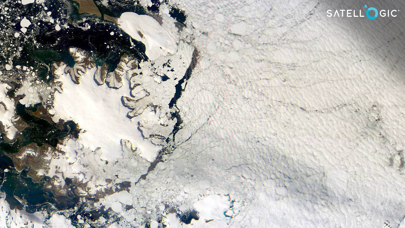
A capture of the Antarctic Peninsula, in the northernmost tip of Antarctica. The continent is, arguably, the largest national park on Earth: the Protocol on Environmental Protection to the Antarctic Treaty signed in 1991 designates Antarctica, which is ~40% larger than Europe, as a “natural reserve, devoted to peace and science.”
In addition, national parks are also necessary for recreational and educational purposes, providing opportunities for people to experience nature, learn about the environment, and bolster their well-being. According to the National Park Service, the year 2021 recorded almost 300 million visits to national parks in the United States. However, recent studies show that, even though time spent outside is beneficial for our health, Americans spend less time outdoors than in the past, and went on 1 billion fewer outings in nature in 2018 compared with 2008.
Studies in different countries draw similar conclusions about the downturn in time spent outdoors: an investigation in the United Kingdom suggests that, nowadays, kids spend half the time their parents did as children. Since several studies have pointed toward the health benefits of spending time outdoors, national parks seem like a specially suitable means for boosting well-being. In this vein, since 2022, doctors in Canada have started prescribing national park visits to patients struggling with mental health issues.
A sub-meter capture of the Llogara National Park in Albania. The Government of Albania recently announced an agreement with Satellogic to develop an EO program under the Constellation-as-a-Service model.
Furthermore, according to the International Union for Conservation of Nature (IUCN), national parks and other protected areas are a significant source of income for many countries, generating over $600 billion globally yearly from tourism and recreation. For example, certain sources specify that ecotourism in Costa Rica, which includes national parks and other protected areas, generates around 5% of the country’s GDP.
The challenges of monitoring national parks
Even for their multi-angled and impactful importance, navigating the wild terrain of national parks can be a daunting task, with vast landscapes and remote locations making it difficult for park managers to keep a watchful eye on all areas. In certain regions, poor infrastructure might even leave park authorities scrambling for a more efficient solution.
In addition, national parks are facing increasing pressure from human activities such as poorly planned urban development, logging, and mining. Besides industrial-scale activities, reckless human behavior — such as the accidental or deliberate start of fires — can also result in catastrophic events for parks harboring flora and fauna.
A multispectral capture of the Glacier National Park in Montana. EO data is especially helpful for areas so big and inaccessible as this park. It covers 4,101 square kilometers, roughly 2.5 times the area of London, United Kingdom.
According to the United Nations Framework Convention on Climate Change (UNFCCC), climate change is also expected to impact environmental variables significantly, including temperature, precipitation, and sea level changes, which can lead to changes in vegetation, wildlife populations, and ecological systems.
So, how can authorities, organizations and stakeholders leverage data from space to overcome the setbacks of the present day — and of the days to come?
The role of EO data in enhancing conservation efforts
EO data can provide a wide range of valuable information for governments and park authorities to face the challenges that imply monitoring vast lands. For example, EO data can be used to create detailed, updated maps of land cover and vegetation, which can help park managers identify and better manage the needs of areas with high conservation value, such as wetlands, forests, lakes, and other vital habitats.
EO data can help park managers identify areas at risk from human activities, such as illegal logging or poaching, and develop strategies to protect them. By monitoring changes in land cover, vegetation, and wildlife populations, EO data can also help park staff mark safe trails for visitors, ensuring the safety of humans and wildlife.
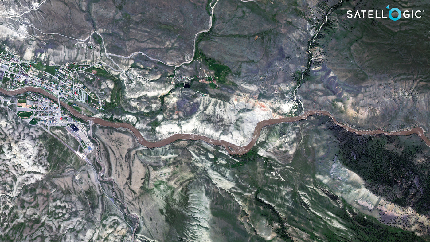
A high-resolution multispectral capture of the town of Gardiner, Montana. The Yellowstone River crosses the town and leads toward the North entrance to the world’s first national park. Yellowstone’s area spreads over different states and is even bigger than the populous Tokyo-Yokohama metropolitan region.
EO data can be used to monitor the impacts of climate change on national parks and other protected areas. Satellogic signed an agreement with the GREEN+ Jurisdictional Programme, through which our constellation will monitor all subnational protected areas on the planet, ensuring the provision of reliable and consistent high-quality satellite data.
The case for wildfire monitoring
The year 2022 was one of the hottest years on record on Earth, and wildfires were a part of it in multiple countries, such as Morocco, Argentina, or Mongolia. One of the regions with the most-recorded fires was California. The official agency Cal Fire recorded 7667 wildfires in the Golden State during 2022 — an average of more than 20 daily incidents.
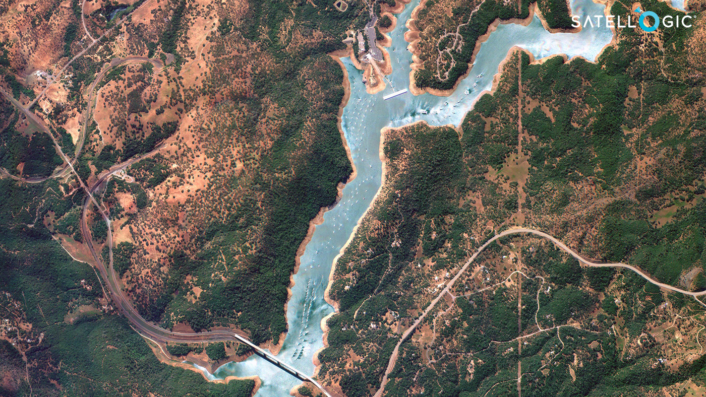
A high-resolution capture of Lake Oroville in California. Situated in a region prone to wildfires, Lake Oroville is part of a state park and one of the largest water reservoirs in California.
Upon such a perilous reality, EO data can be used to monitor the spread of fires and to track the impacts of fires on national parks and other protected areas.
EO data can help detect and map wildfires in near real-time, providing authorities with a detailed understanding of the fire’s location, size, and intensity.
One of the ways to monitor wildfires is by observing the whole electromagnetic spectrum. Since many EO satellites — such as those from Satellogic’s constellation — are equipped with multimodal, versatile technology, national parks can perform wildfire analyses using a multispectral camera’s Near InfraRed band (NIR). This band comprises low-frequency radiation adjacent to red hues of what’s visible, with wavelengths between 750–900 nm. The noticeable brightness in the NIR that helps spot wildfires occurs due to reflected sunlight. Satellogic’s multispectral sensor, for its part, has all bands (RGB and NIR) at the same native resolution; therefore, organizations using Satellogic’s EO data don’t need to perform pansharpening processes and, thus, hold no risk of losing spectral information.
This information can be used to determine the most appropriate response, such as evacuating nearby communities, deploying firefighting resources, and establishing fire control plans.
In some cases, seasonal wildfires occur as part of a forest’s lifecycle, and high-resolution and updated imagery can also help monitor and take appropriate action. For example, according to official records, the cedars at the Glacier National Park in Montana catch fire nearly every year, a natural occurrence in the lifecycles of these forests. Natural or not, EO data can help keep an eye on fires for the safety of park guests and wildlife.
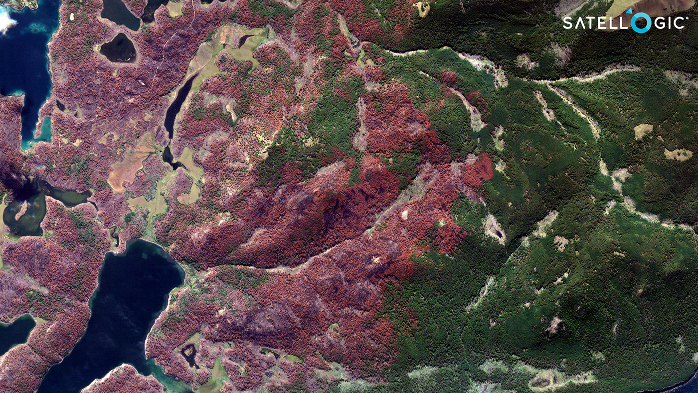
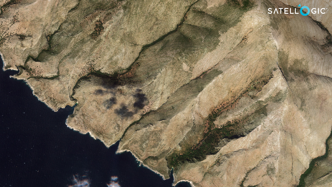
A high-resolution capture of a protected area in Tierra del Fuego, Argentina, in the southernmost tip of South America. Inattentive human behavior can spark off wildfires, such as the one that led to the burned patches visible in this image.
Furthermore, after a wildfire, EO data can be used to map the burned area, providing authorities with a detailed understanding of the extent of the damage. A recent multispectral capture of a protected area in the southernmost province of Tierra del Fuego, Argentina, demonstrated how a wildfire had spread through an area the size of Barcelona, Spain. Satellite constellations can deliver high-resolution captures of such catastrophes to help authorities define if the wildfire is controlled or still active.
Sustainable preservation with EO data
In conclusion, Earth Observation data can be a crucial component in the data stack that national parks can rely on. EO data provides detailed and up-to-date information, which can be used to support the monitoring, management, and research activities crucial to preserving these valuable areas.
By counting on ever-growing satellite constellations, stakeholders worldwide can leverage accessible and affordable EO data to help toward the national parks’ sustainable preservation.
Want to learn more about our satellite constellation? Let’s start a conversation. Contact Sales.


