Affordable, near-real time intelligence at scale
Satellogic offers GEOINT autonomy with encrypted global tasking capacity, data access, and management, plus a direct satellite purchase opportunity to meet asset ownership requirements. We believe every leader should have access to relevant and timely information to strengthen national security, enhance economic prosperity, and prepare for a more sustainable future.
Satellogic holds a NOAA Remote Sensing License.
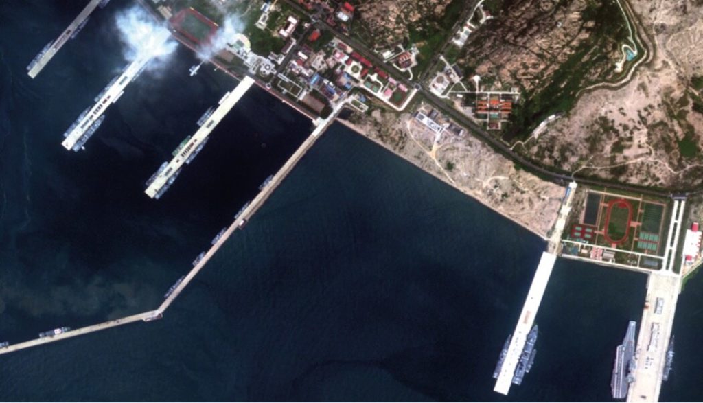
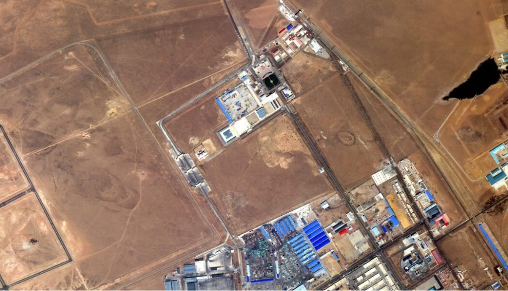
Defense & Intelligence Missions
Our end-to-end solutions enhance security-related decisions to meet today’s demands and anticipate tomorrow’s challenges.
- Object Detection
- Feature Extraction and Change Detection
- Critical Infrastructure Monitoring
- Corridor Mapping
- Maritime Safety and Environmental Protection
- Border Control
- Activity Monitoring
- Situational Damage Assessment
- Key Site Analysis
- Support to Policy, Operations and Mission Planning
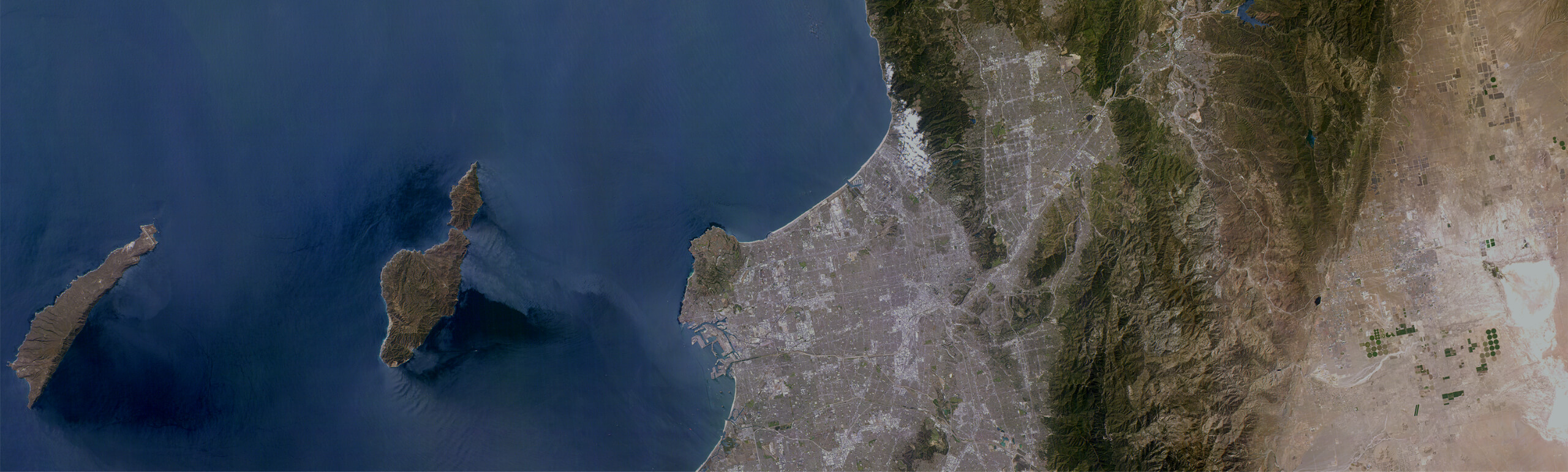
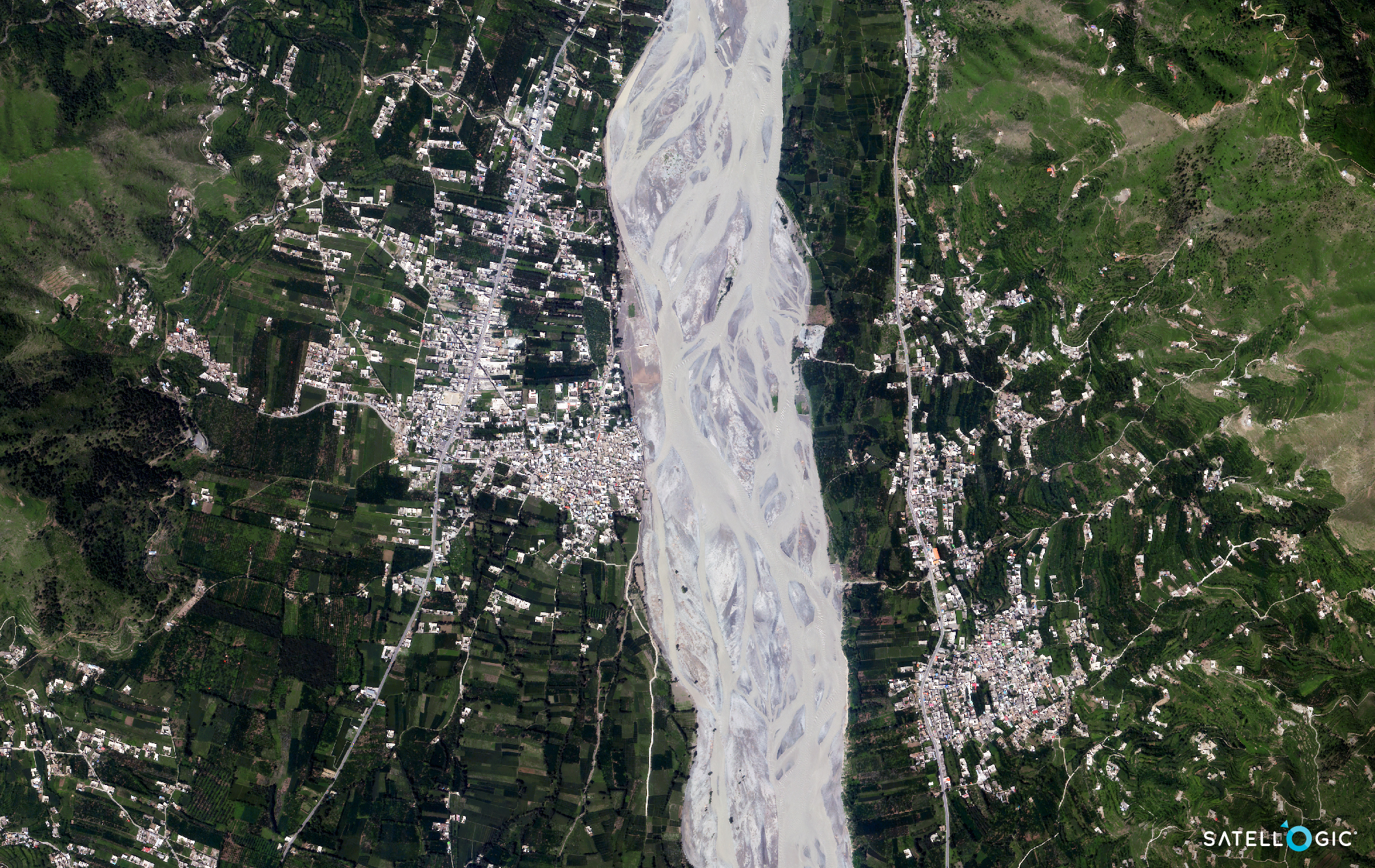
Remote Regions and Border Control
Leveraging our versatile constellation of high-resolution satellites with diverse capabilities, we are uniquely positioned to monitor areas of geopolitical significance—especially within contentious border areas.
- Monitor both at-risk and high-interest border areas
- Identify “unofficial” border crossings that materialize as a result of a conflict or natural disaster
- Track the construction activity of border infrastructure projects
- Provide early warning to individuals and organizations operating in affected regions
- Mobilize resources sooner with near real-time situational awareness
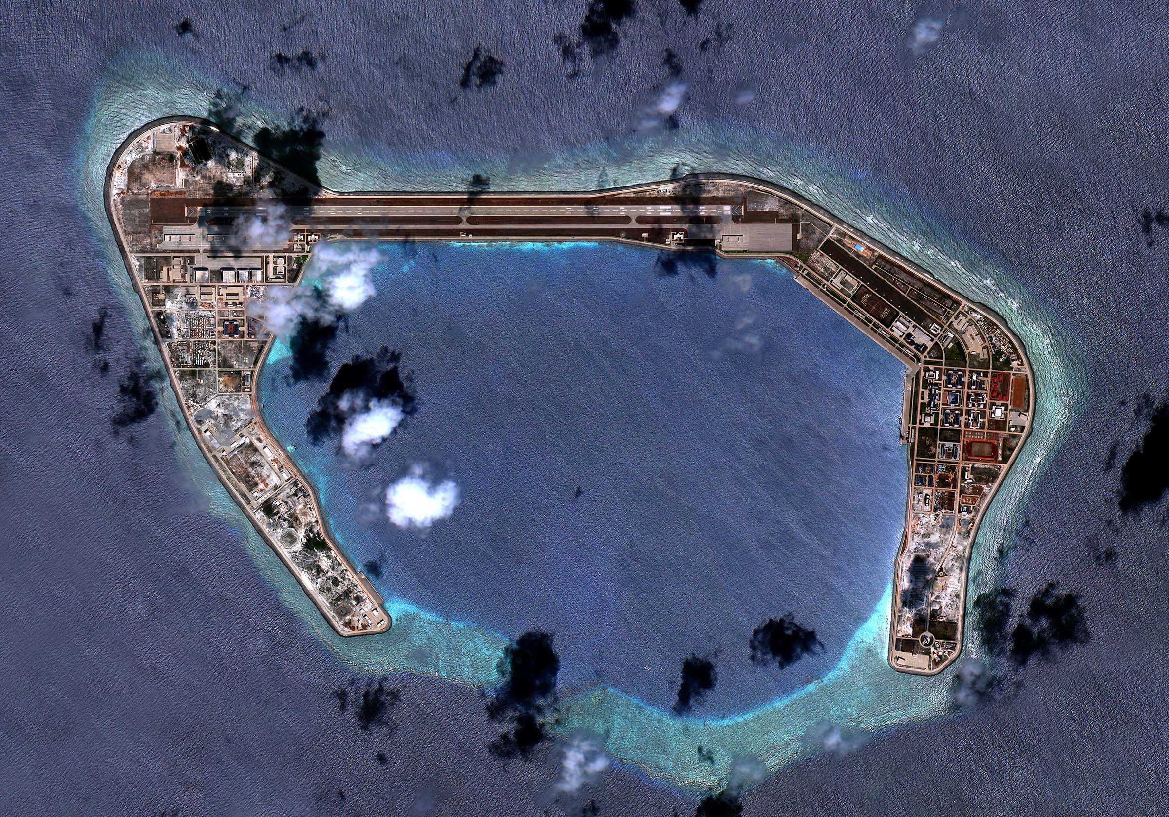
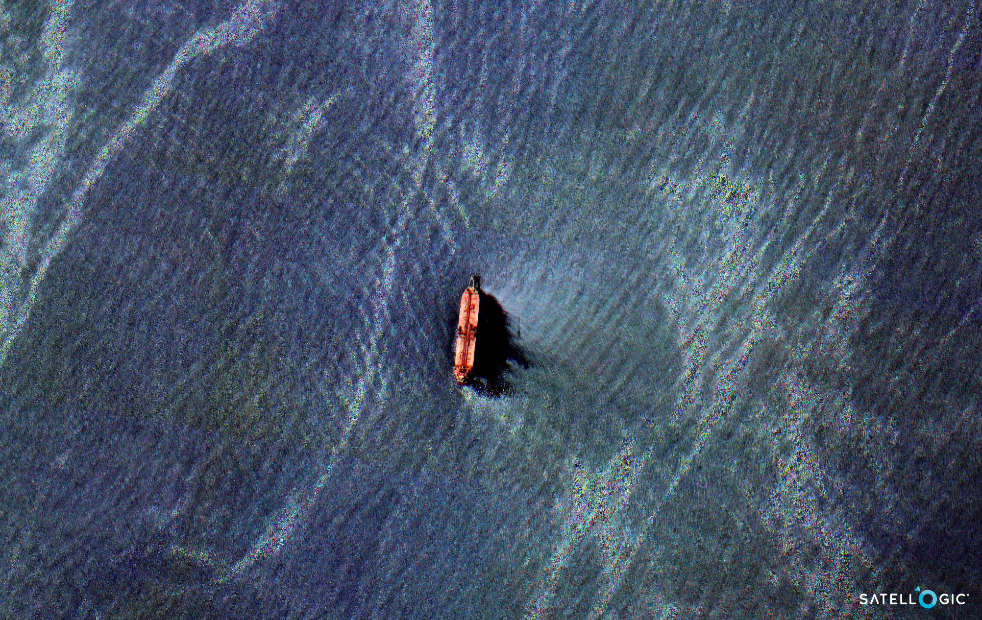
Maritime Situational Awareness
Satellogic can deliver actionable information to satisfy national security objectives in the maritime domain while conserving resources. Our high-resolution, high-frequency imagery and full-motion video capabilities enable marine surveillance and security agencies to prevent nefarious activity at sea, such as illegal fishing, human trafficking, and illicit transshipment activity.
- Scalable surveillance to conserve resources
- Static and motion-imagery based evidence to pursue investigations of illicit activity
- Multispectral and Hyperspectral imagery to analyze algal blooms and other marine hazards
- High-frequency collections to expedite search and rescue missions
Humanitarian Assistance & Disaster Response
As a member of the International Disasters Charter, Satellogic is committed to providing consequential services to those in need. Our imagery is immediately made available to local, national, and international disaster response organizations to assist with the coordinated rapid response effort.
- Population density mapping for resource allocation
- Safe and unobstructed routing for search and rescue teams
- Pre and post-event imagery to assess damage (or conduct damage assessment analysis) – government vs. private infrastructure damage
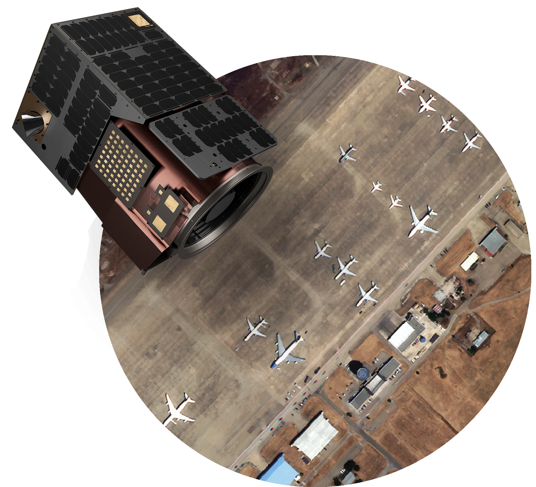
Purchase an EO Satellite
Starting at less than $10M (including launch, mission operations, and support), you can acquire and deploy your very own high-resolution Earth Observation satellite.
Satellogic Receives NOAA License
Satellogic now meets requirements for additional U.S. Government and allied nation contracts, supporting its U.S.-focused strategy.
See for Yourself
Our unique Constellation-as-a-Service model enables organizations to manage direct tasking of our satellites over a specified area of interest.