Ndassima Gold Mine: Observed Industrial Expansion in CAR
By The Satellogic Team
Observing the evolution of a critical resource hub through repeat satellite imagery.
In the Central African Republic (CAR), the Ndassima Gold Mine has become far more than a remote extraction site. Over the last several years, it has emerged as a strategic economic hub tied to broader networks of security, influence, and resource control across the region.
Open-source reporting has described Ndassima as part of a “security-for-resources” model in which armed actors provide regime protection in exchange for privileged access to mining operations. Since 2020, entities linked to the Vagner Group, now transitioning into the Kremlin-controlled Africa Corps, have reportedly consolidated control over the site, transforming it into an increasingly mechanized, industrial-scale operation.
Estimates suggest the mine may generate up to $290 million in annual gold revenue, with material moving through complex transportation and smuggling routes that are difficult to track through traditional means alone.
This is precisely where satellite imagery provides unique value: offering persistent, independent visibility into activity at sites that are otherwise inaccessible, high-risk, or politically sensitive.
A Site That Has Shifted From Artisanal Extraction to Industrial Production
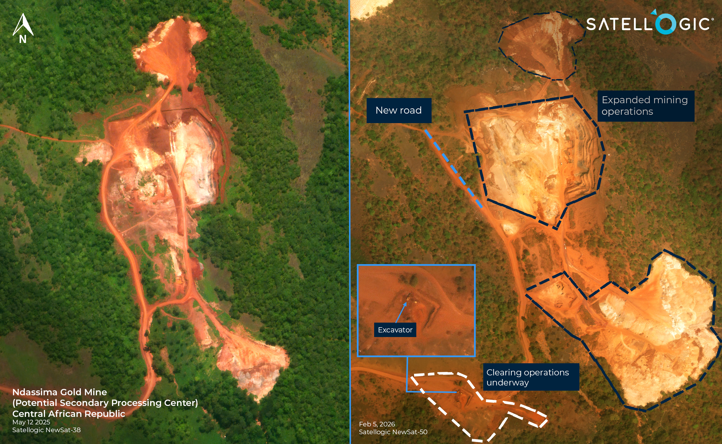
Satellogic imagery collected on May 12, 2025, illustrates Ndassima’s role as a highly organized production facility.
From orbit, the mine is clearly structured into specialized operational zones, including:
- Two distinct mechanized processing lines
- Extensive ore storage areas
- Dedicated support and housing infrastructure for personnel
- Large-scale tailings storage systems to manage chemical waste produced during extraction
The presence of engineered tailings ponds is particularly notable, reflecting the site’s evolution from smaller-scale digging into a fully industrialized mining complex.
Continued Expansion Visible Into 2026
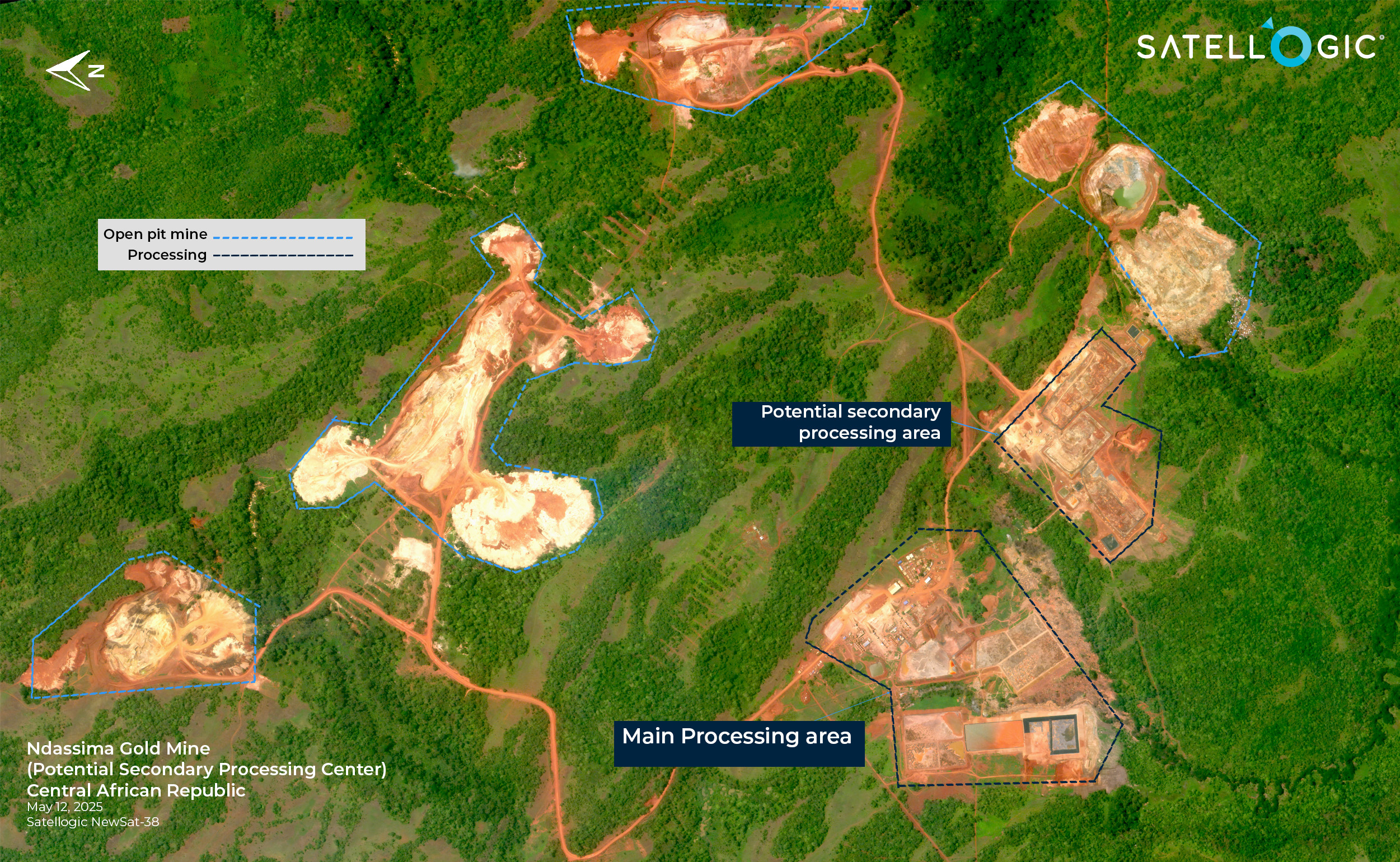
By early 2026, the pace of development had not slowed.
Satellite imagery from February 5, 2026, reveals that Ndassima’s waste-management footprint has expanded significantly since 2025, with newly constructed tailings storage ponds visible adjacent to earlier infrastructure.
Operational activity remains apparent across the site:
- The main processing and ore storage zones remain active
- A secondary processing center shows visible rock crushers and parallel processing lines
- Multiple expansion areas contain excavators and other heavy construction equipment
This sustained mechanization supports continued high-volume production, reinforcing the mine’s reported role as a major revenue source linked to Russian regional operations and efforts to evade international sanctions.
Timeline of Observed Change
May 12, 2025
- Potential secondary processing area identified
- Two primary processing lines visible
- Support and housing infrastructure established
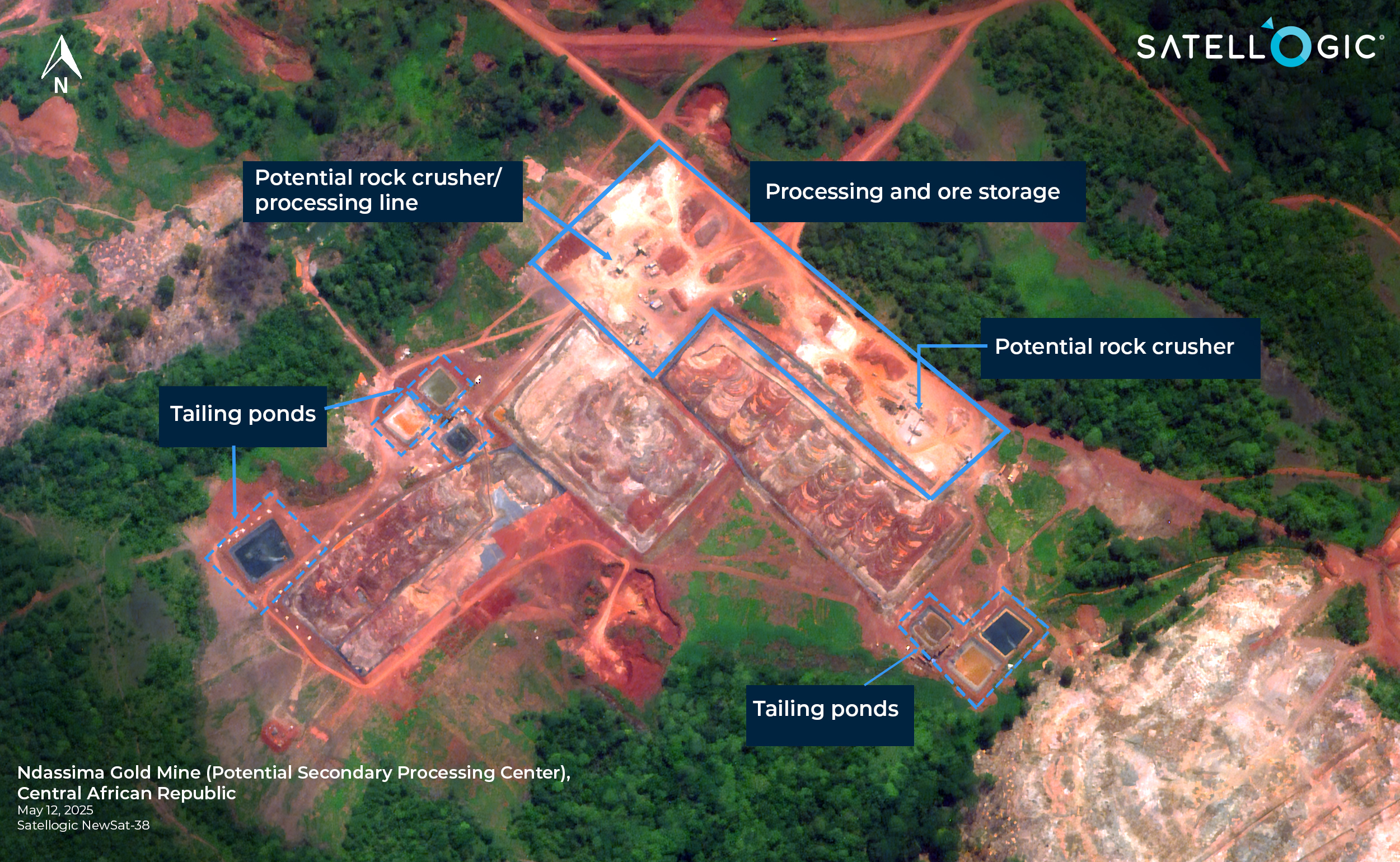
2025 overview and baseline of Ndassima Gold Mine and Processing Sites
February 2026
- Main processing, ore storage, and housing remain active
- Secondary processing zones still operational, with visible crushers
- Expansion of mining operations underway
- Tailings storage ponds significantly enlarged
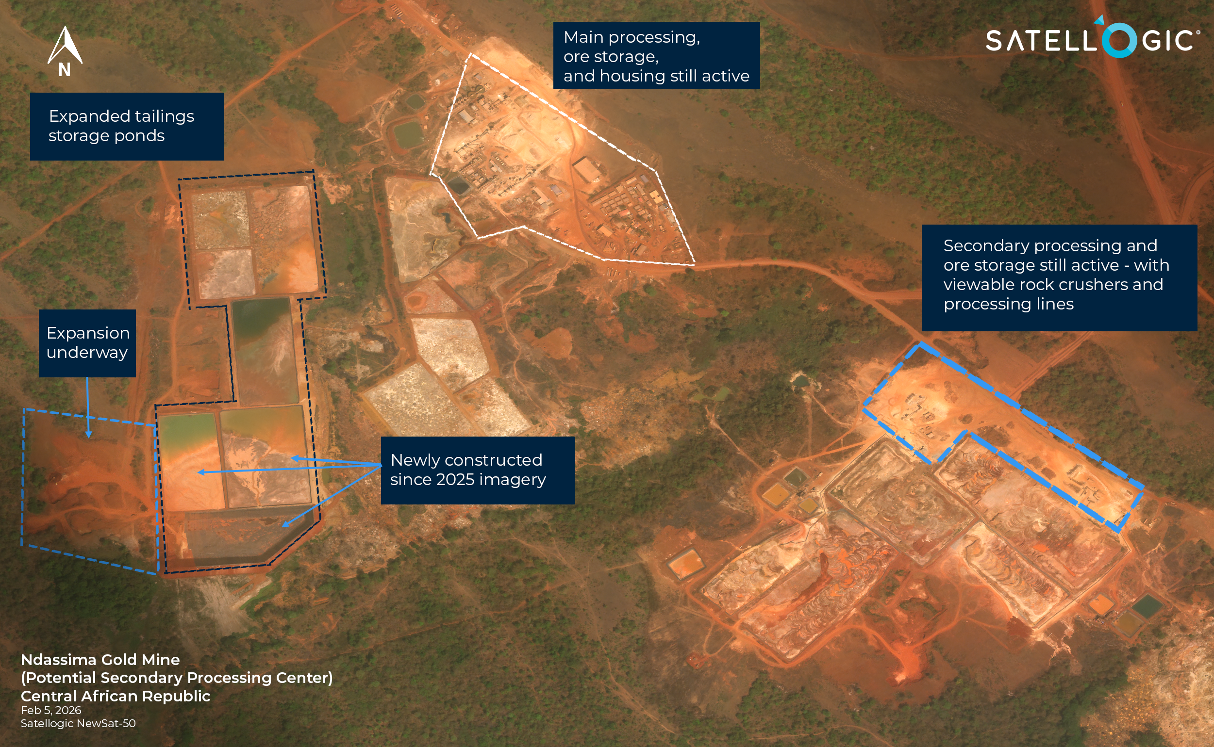
2026 observed expansion and activity at the primary and secondary processing sites
Why This Matters
Ndassima is a clear example of how satellite imagery can support analysis of:
- Industrial development in remote regions
- Resource-linked security dynamics
- Infrastructure growth over time
- The evolution of extraction sites into strategic economic hubs
From space, the signals of sustained production, and the networks surrounding it, become visible.
2025 – 2026 Ndassima Open Pit Mine Expansion
Outlook: Monitoring What Comes Next
Satellogic will continue monitoring Ndassima for further updates and follow-on analysis. We also plan to produce an overview product on Idere Mine, another gold mining site in the Central African Republic currently associated with Africa Corps (formerly Vagner).