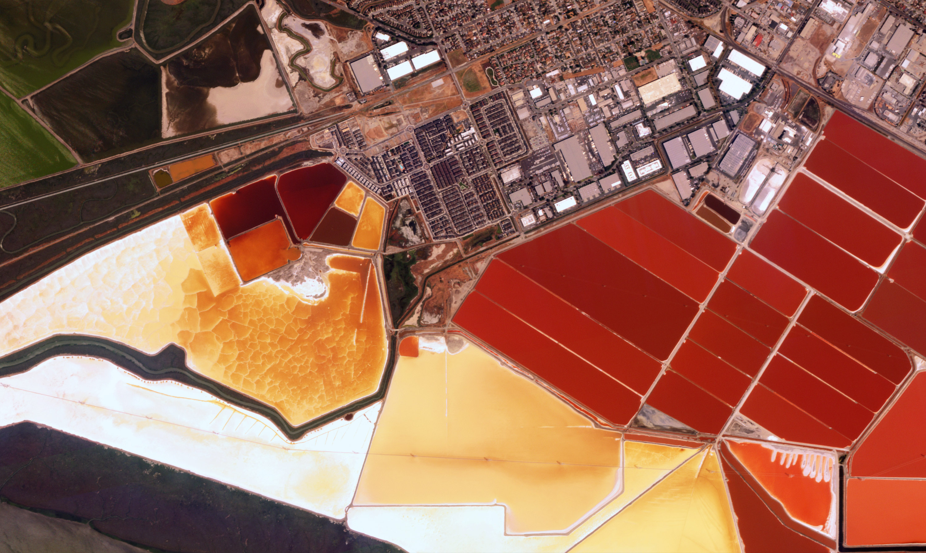
Affordable, high-frequency and high-resolution imagery
With the largest commercial Earth Observation constellation in orbit, our customers stream rich geospatial data at unmatched:
FREQUENCY
Multiple daily revisits of any point of interest
RESOLUTION
Patented technology delivers multispectral imagery at sub-meter resolution
COST
High-resolution imagery at the industry’s most competitive price point
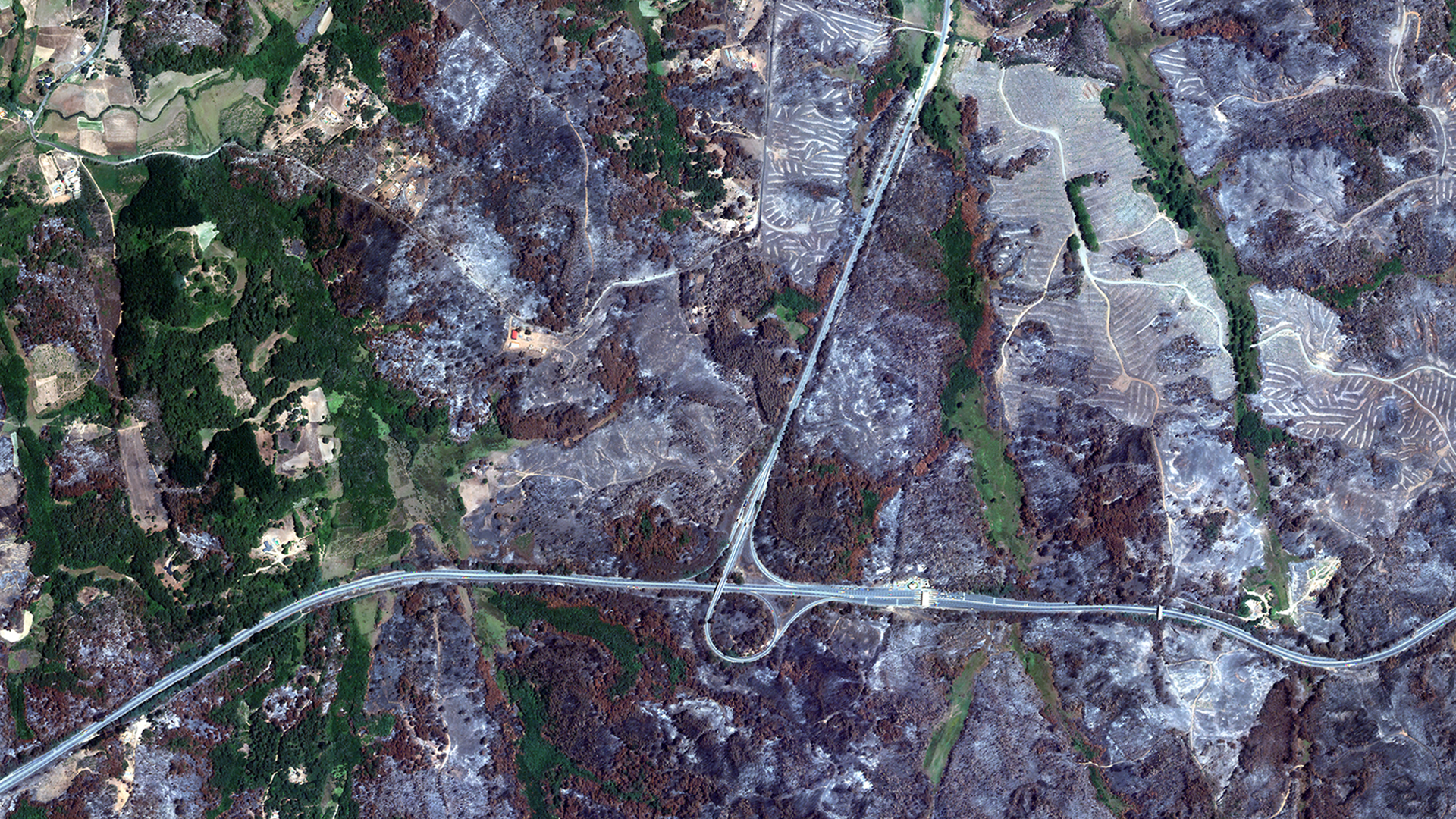
On January 30, 2023, a series of wildfires broke out in Chile. By early February, more than 400 individual fires had spread across the nation, burning approximately 430,000 hectares (1,100,000 acres), as seen in the left image. The government declared a state of emergency in multiple regions of the country; 24 lives were lost.
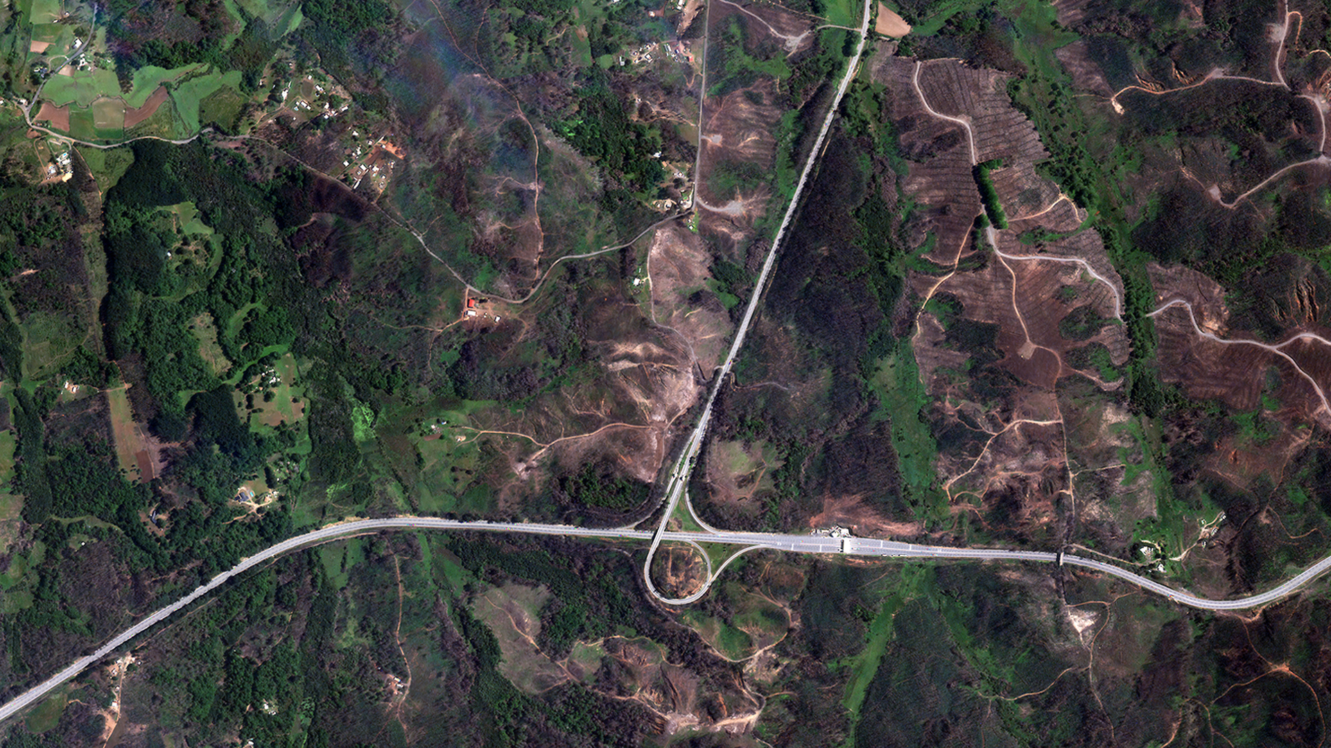
A few months later, the environment has begun to heal. In the image on the right, burnt areas have recovered with healthy vegetation. Satellite imagery enables analysts to study different types of environments at greater scale and frequency; this supports the development of advanced risk mitigation strategies as well as emergency response and recovery.
The Best Price Point
More affordable data means more data to train algorithms, monitor change, and enhance situational awareness across the globe.
Archive Orders
$4 per km2
Standard Tasking*
$8 per km2
Priority Tasking*
$12 per km2

Rush Tasking
$18 per km2
Rapid Response
$20 per km2
* Cloud Cover Uplift (<5%): $4 per km2
Cloud Cover Uplift (<10%): $2 per km2
Cloud Cover Uplift (<15%): $1 per km2
Constrained Off-Nadir Angle Upllift (25 degrees or less): $2 per km2
The Global Leader in High-Resolution Data Collection from Space
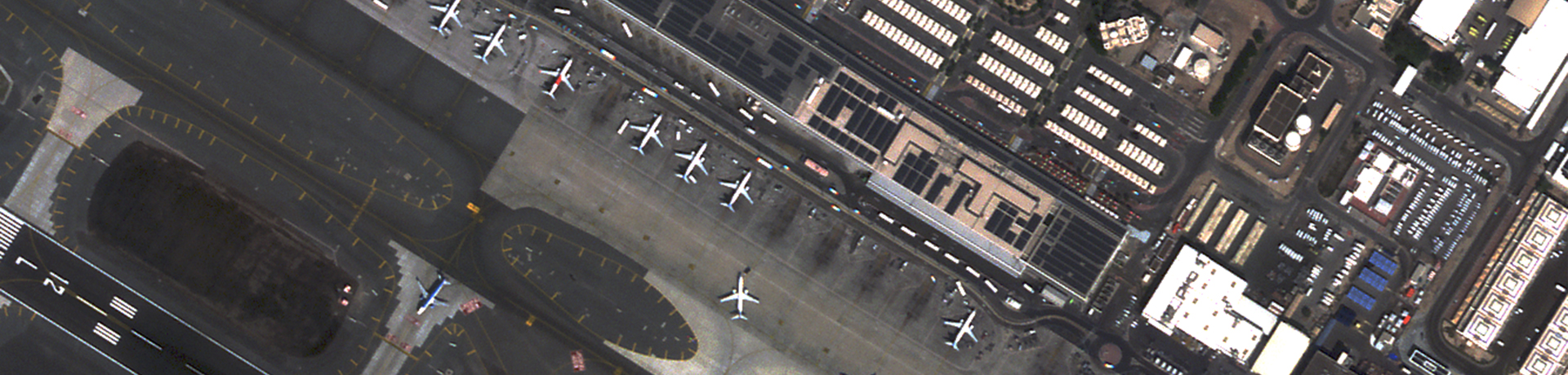
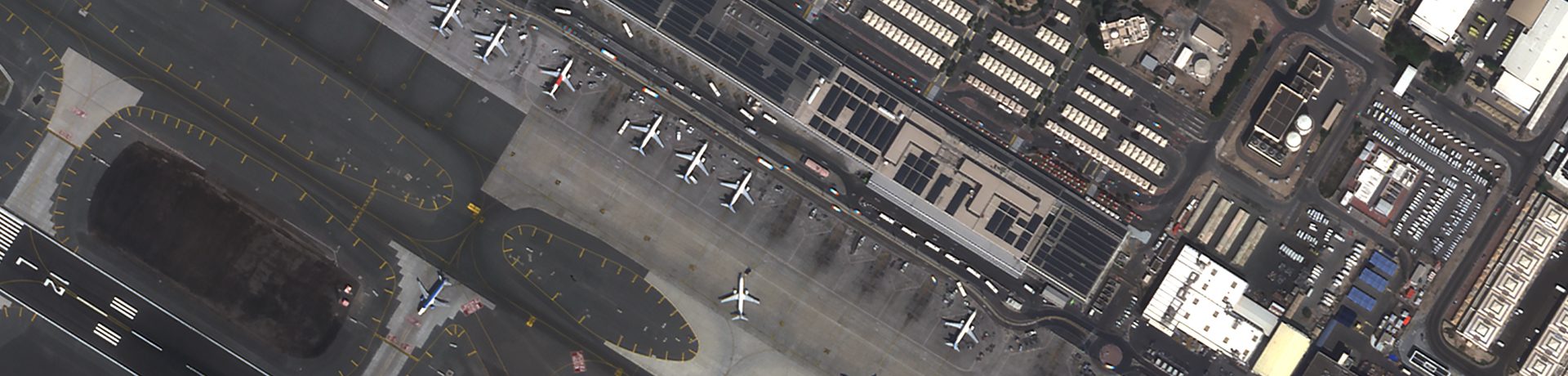
Satellogic multispectral imagery allows you to monitor economic activity and high-frequency changes to infrastructure and natural environment with sub-meter detail.
PRODUCTS Specifications
| Imagery Product | L1 Basic | L1 Ortho | L1 Ortho SR |
|---|---|---|---|
| Pixel Resolution | ~99 cm GSD native (depends on ONA) | 99 cm GSD | 70 cm GSD SuperResolution |
| Wavelengths | Blue: 450 – 510 nm Green: 510 – 580 nm Red: 590 – 690 nm NIR: 750 – 900 nm | Blue: 450 – 510 nm Green: 510 – 580 nm Red: 590 – 690 nm NIR: 750 – 900 nm | Blue: 450 – 510 nm Green: 510 – 580 nm Red: 590 – 690 nm NIR: 750 – 900 nm |
| Geolocation Accuracy | Terrestrial – 20m CE90 Maritime – 300m CE90 | 10 m CE90 | 10 m CE90 |
| Image Delivery bits/pixel | TOA 16 bits VISUAL 8 bits | TOA 16 bits VISUAL 8 bits | TOA 16 bits VISUAL 8 bits |
| File Format | GeoTiff | GeoTiff | GeoTiff |
| File Compression | LZW lossless | LZW lossless | LZW lossless |
| Image Metadata | ISO and STAC | ISO and STAC | ISO and STAC |
| Projection | UTM/WGS84 | UTM/WGS84 | UTM/WGS84 |
| Swath Width | 5 km | 5 km | 5 km |
| Coverage | Maritime, Terrestrial | Terrestrial | Terrestrial |
Ready for a conversation with our team
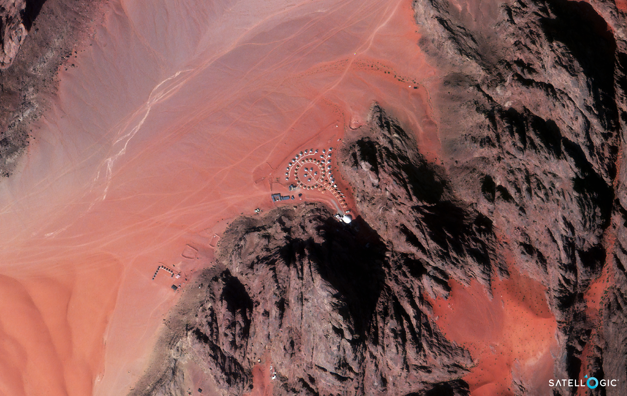
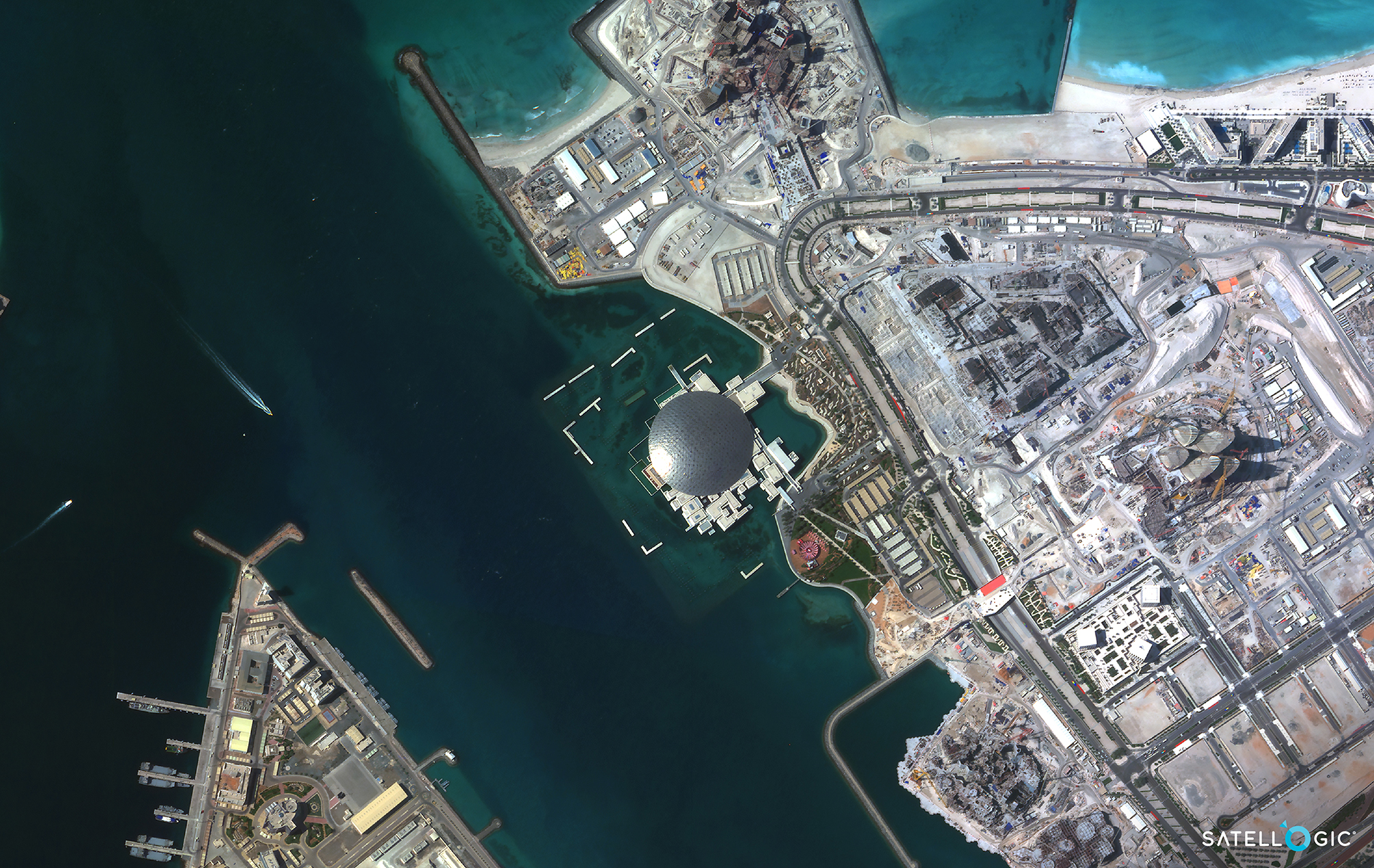
Sample Images

asset monitoring
Data Sheet
rapid response
Data Sheet
Enhance your decision-
making processes
with affordable geospatial imagery